Open land at the corner of Stretton Avenue and Dunsmore Avenue, Willenhall, Coventry
Introduction
The photograph on this page of Open land at the corner of Stretton Avenue and Dunsmore Avenue, Willenhall, Coventry by Robin Stott as part of the Geograph project.
The Geograph project started in 2005 with the aim of publishing, organising and preserving representative images for every square kilometre of Great Britain, Ireland and the Isle of Man.

There are currently over 7.5m images from over 14,400 individuals and you can help contribute to the project by visiting https://www.geograph.org.uk
Open land at the corner of Stretton Avenue and Dunsmore Avenue, Willenhall, Coventry
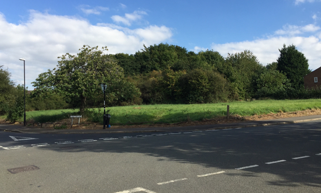
Image: © Robin Stott Taken: 5 Oct 2016
Dunsmore Avenue runs across the picture, climbing left to right. The dense growth of scrub is on a strip of land running back from St James' Lane. A map of 1938 shows a small building on it, identified in 1947 as greenhouses and the land as 'Market Garden'. From the 1950s to the 1970s it is shown as 'Nursery'; a building appears at the front of the site. On a map of 1982 the site is unidentified and by 1992 carries tree symbols. Bollards at the edge of the trees, right, suggest public access.
Images are licensed for reuse under creativecommons.org/licenses/by-sa/2.0
Image Location
Latitude
52.386135
Longitude
-1.466456