
IMAGES TAKEN NEAR TO
King Richard Street, COVENTRY, CV2 4FU
Introduction
This page details the photographs taken nearby to King Richard Street, CV2 4FU by members of the Geograph project.
The Geograph project started in 2005 with the aim of publishing, organising and preserving representative images for every square kilometre of Great Britain, Ireland and the Isle of Man.

There are currently over 7.5m images from over14,400 individuals and you can help contribute to the project by visiting https://www.geograph.org.uk
Image Map
Images are licensed for reuse under creativecommons.org/licenses/by-sa/2.0
Notes
- Clicking on the map will re-center to the selected point.
- The higher the marker number, the further away the image location is from the centre of the postcode.
Image Listing (69 Images Found)
Images are licensed for reuse under creativecommons.org/licenses/by-sa/2.0
Image
Details
Distance
1
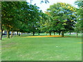
Gosford Green
At the Junction of Walsgrave and Binley Roads. In 1940 90 people were killed when a bomb hit an air raid shelter here.
Image: © Kevin Croucher
Taken: 13 Jun 2005
0.07 miles
2
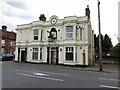
Binley Oak Pub, Paynes Lane
This pub opened in 1850, and was renovated in 1895, as shown by the dates on the frontage.
It is named after an ancient oak which stood in the Binley area of the city, which is shown on a painting by Edwin Brown c1848 now in the Herbert Art Gallery and Museum.
The pub had closed by 2010.
Image: © Keith Williams
Taken: 13 May 2015
0.09 miles
3
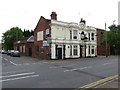
Binley Oak Pub, Paynes Lane
The frontage of the pub can also be seen in Image
Image: © Keith Williams
Taken: 13 May 2015
0.09 miles

5
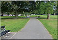
Small park at Gosford Green
This triangular shaped park is surrounded by the busy A444, A4600 Walsgrave Road, and the A428 Binley Road.
Image: © Mat Fascione
Taken: 11 Sep 2014
0.10 miles
6

Path across Gosford Green towards Walsgrave Road
Gosford Green is a triangular park surrounded by busy roads to the east of Coventry city centre. Once much larger, it was the place from where in 1398, King Richard II sent Thomas de Mowbray, Earl of Norfolk, and Henry Bolingbroke into exile, cancelling the trial by combat which was to have decided the fate of the two men, each of whom had accused the other of treason. The scene is portrayed at the beginning of Shakespeare's 'Richard II'. Bolingbroke later deposed Richard and was crowned Henry IV. A street to the north of Gosford Green is named King Richard Street. There are also streets named after Mowbray and Bolingbroke in the neighbourhood.
Image: © A J Paxton
Taken: 19 May 2018
0.10 miles
7
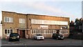
Mosque, Paynes Lane, Hillfields
The mosque is called Masjid Al Madinah Al Munawwarah and is the address of the Coventry Muslim Swahili Association. It uses a former factory building in the 'moderne' style, with some curved corners and glass bricks, so perhaps of 1930s date.
Image: © A J Paxton
Taken: 6 Jan 2024
0.10 miles
8
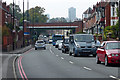
Walsgrave Road in Coventry
In the distance is the A444 road bridge.
Image: © Mat Fascione
Taken: 11 Sep 2014
0.11 miles
9
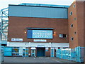
Highfield Road Stadium
Until 2005, home to Coventry City FC. Soon to be demolished for housing. The City hope to start the 2005 season in their new stadium at the Ricoh Arena
Image: © Kevin Croucher
Taken: 13 Jun 2005
0.11 miles
10
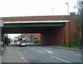
Coventry-Walsgrave Road
The bridge carries the A444 road which follows the course of the dismantled loop line which enabled the coal trains to avoid Coventry Station.
Image: © Ian Rob
Taken: 24 Jun 2011
0.11 miles