Mosque, Paynes Lane, Hillfields
Introduction
The photograph on this page of Mosque, Paynes Lane, Hillfields by A J Paxton as part of the Geograph project.
The Geograph project started in 2005 with the aim of publishing, organising and preserving representative images for every square kilometre of Great Britain, Ireland and the Isle of Man.

There are currently over 7.5m images from over 14,400 individuals and you can help contribute to the project by visiting https://www.geograph.org.uk
Mosque, Paynes Lane, Hillfields
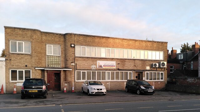
Image: © A J Paxton Taken: 6 Jan 2024
The mosque is called Masjid Al Madinah Al Munawwarah and is the address of the Coventry Muslim Swahili Association. It uses a former factory building in the 'moderne' style, with some curved corners and glass bricks, so perhaps of 1930s date.
Images are licensed for reuse under creativecommons.org/licenses/by-sa/2.0
Image Location
Latitude
52.410633
Longitude
-1.492844