
IMAGES TAKEN NEAR TO
Oxford Street, COVENTRY, CV1 5EH
Introduction
This page details the photographs taken nearby to Oxford Street, CV1 5EH by members of the Geograph project.
The Geograph project started in 2005 with the aim of publishing, organising and preserving representative images for every square kilometre of Great Britain, Ireland and the Isle of Man.

There are currently over 7.5m images from over14,400 individuals and you can help contribute to the project by visiting https://www.geograph.org.uk
Image Map
Images are licensed for reuse under creativecommons.org/licenses/by-sa/2.0
Notes
- Clicking on the map will re-center to the selected point.
- The higher the marker number, the further away the image location is from the centre of the postcode.
Image Listing (109 Images Found)
Images are licensed for reuse under creativecommons.org/licenses/by-sa/2.0
Image
Details
Distance
4
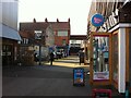
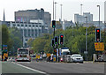
Fargo Village, looking onto Far Gosford Street
The main entrance to & exit from the Fargo Village business centre. On the left can be seen the entrance to The Box, a performance and event space. In the distance is the end of a row of ribbon weavers' houses on Far Gosford Street, with their distinctive large 'top shop' windows.
Image: © A J Paxton
Taken: 24 Jul 2021
0.06 miles
5
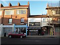
Coventry-Far Gosford Street
Regeneration on one of Coventry's oldest streets. Note the Topshop.
Image: © Ian Rob
Taken: 6 Dec 2014
0.06 miles
7
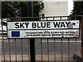
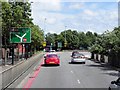
Road sign, Sky Blue Way, Coventry
Sky Blue Way is a stretch of dual carriageway connecting the Coventry Ring Road to the A444 Jimmy Hill Way. It was built in the 1980s to bypass the historic Far Gosford Street (and clearly the European Community chipped in). It was named after the colour of Coventry City Football Club, winners of the FA Cup in 1987, who at that time still played at the Highfield Road stadium nearby (Jimmy Hill had been the manager who had brought them to first division prominence some years earlier).
Image: © A J Paxton
Taken: 22 Jul 2021
0.06 miles
8
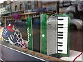
Polish-Ukrainian restaurant, Far Gosford Street, Coventry
An accordion displayed in the window of the Slovianka Polish & Ukrainian restaurant (more correctly spelled Slowianka perhaps, but Slovianka appears on the sign outside). It has since been joined by on the windowsill by a Polish weighing scale of perhaps 1950s vintage.
Image: © A J Paxton
Taken: 19 Mar 2019
0.07 miles
9
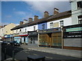
Coventry-Far Gosford Street
Shops and restaurants near the junction with Binley Road. The shops seem to be single storey add ons in front of what were originally houses.
Image: © Ian Rob
Taken: 14 Apr 2008
0.07 miles
10
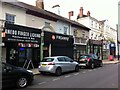
Shops of Far Gosford Street, Coventry, on the north side and eastern end
Far Gosford Street is an early suburb of Coventry that developed in the middle ages along the road east out of the city towards Leicester and London. It survived the air raids of the second world war and the redevelopment of the postwar years largely intact. It was declared a conservation area in the 1990s and in recent years has undergone a 'regeneration' programmed that has succeeded in reversing its decline without destroying its character, which rests both in its buildings and its independent businesses. https://www.coventrysociety.org.uk/news/article/new-heritage-group-for-far-gosford-street.html
This section has a row of 19th century houses and commercial buildings with stucco facades, once known as Ashville Terrace. The gardens were covered over with extended shop fronts in the early 20th century. Anedo is a Nigerian chop house and bar; beyond it are a pizza house, a guitar shop, a Polish-Ukrainian restaurant ('Slovianka'), then two of the street's many barber shops, one of them East African.
The larger three storey building beyond them was home to the Coronet Cycle Works at the end of the 19th century and later the Humber Motor Works; it was rebuilt after a fire in 1906. https://www.historiccoventry.co.uk/nowandthen/content.php?pg=humber-wks It lost its rear section to the construction of Sky Blue Way in the 1980s; the rest housed a branch of Lloyds Bank for many years. More information can be found in 'The Far Gosford Street Conservation Area: Brief History and Character Statement' at http://www.coventry.gov.uk
Image: © A J Paxton
Taken: 24 Jul 2021
0.07 miles