Shops of Far Gosford Street, Coventry, on the north side and eastern end
Introduction
The photograph on this page of Shops of Far Gosford Street, Coventry, on the north side and eastern end by A J Paxton as part of the Geograph project.
The Geograph project started in 2005 with the aim of publishing, organising and preserving representative images for every square kilometre of Great Britain, Ireland and the Isle of Man.

There are currently over 7.5m images from over 14,400 individuals and you can help contribute to the project by visiting https://www.geograph.org.uk
Shops of Far Gosford Street, Coventry, on the north side and eastern end
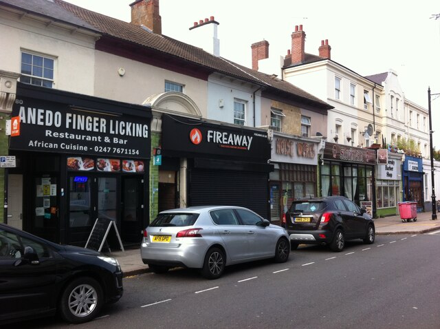
Image: © A J Paxton Taken: 24 Jul 2021
Far Gosford Street is an early suburb of Coventry that developed in the middle ages along the road east out of the city towards Leicester and London. It survived the air raids of the second world war and the redevelopment of the postwar years largely intact. It was declared a conservation area in the 1990s and in recent years has undergone a 'regeneration' programmed that has succeeded in reversing its decline without destroying its character, which rests both in its buildings and its independent businesses. https://www.coventrysociety.org.uk/news/article/new-heritage-group-for-far-gosford-street.html This section has a row of 19th century houses and commercial buildings with stucco facades, once known as Ashville Terrace. The gardens were covered over with extended shop fronts in the early 20th century. Anedo is a Nigerian chop house and bar; beyond it are a pizza house, a guitar shop, a Polish-Ukrainian restaurant ('Slovianka'), then two of the street's many barber shops, one of them East African. The larger three storey building beyond them was home to the Coronet Cycle Works at the end of the 19th century and later the Humber Motor Works; it was rebuilt after a fire in 1906. https://www.historiccoventry.co.uk/nowandthen/content.php?pg=humber-wks It lost its rear section to the construction of Sky Blue Way in the 1980s; the rest housed a branch of Lloyds Bank for many years. More information can be found in 'The Far Gosford Street Conservation Area: Brief History and Character Statement' at http://www.coventry.gov.uk
Images are licensed for reuse under creativecommons.org/licenses/by-sa/2.0
Image Location
Latitude
52.408278
Longitude
-1.493091