
IMAGES TAKEN NEAR TO
Thomas Street, COVENTRY, CV1 3HL
Introduction
This page details the photographs taken nearby to Thomas Street, CV1 3HL by members of the Geograph project.
The Geograph project started in 2005 with the aim of publishing, organising and preserving representative images for every square kilometre of Great Britain, Ireland and the Isle of Man.

There are currently over 7.5m images from over14,400 individuals and you can help contribute to the project by visiting https://www.geograph.org.uk
Image Map
Images are licensed for reuse under creativecommons.org/licenses/by-sa/2.0
Notes
- Clicking on the map will re-center to the selected point.
- The higher the marker number, the further away the image location is from the centre of the postcode.
Image Listing (419 Images Found)
Images are licensed for reuse under creativecommons.org/licenses/by-sa/2.0
Image
Details
Distance
1
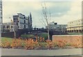
Former canal bridge, Meadow Street
This canal bridge, made by Horseley Iron Works, was removed from near Sowe Common (SP3782) in the early 1970s during construction work for the M6, which at that point runs very close by the canal. It was installed here as a footbridge over the River Sherbourne. The flats and maisonettes nearby were built in the 1950s and 1960s to replace Victorian red-brick terraces.
In 2009: http://www.geograph.org.uk/photo/1182125
Image: © E Gammie
Taken: Unknown
0.01 miles
2
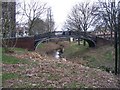
Former canal bridge near Meadow Street
The lettering on the left of the arch reads 'Horseley Iron Works', the firm in Tipton which made several bridges like this for the Oxford canal. It was installed here as a footbridge over the river Sherbourne in the early 1970s after being removed from near Sowe Common (SP3782) during construction work for the M6, which at that point runs very close by the canal. The bridges were originally installed over redundant loops on the Oxford canal when it was straightened during the 19th century. Other examples can be seen at Braunston: http://www.geograph.org.uk/photo/1170434; Newbold on Avon : http://www.geograph.org.uk/photo/59373 and Cathiron: http://www.geograph.org.uk/photo/825458 and http://www.geograph.org.uk/photo/457733
A 1974 view: http://www.geograph.org.uk/photo/1182119
A scheduled monument (ID 1005883)
Image: © E Gammie
Taken: 27 Feb 2009
0.01 miles
3
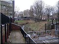
River Sherbourne junk trap
This is the point where the river Sherbourne passes under Meadow Street and begins its culverted journey under the city centre. The bridge is a former Oxford canal bridge made by Horseley Iron Works. The nearby flats and maisonettes were built in the 1950s and 1960s to replace Victorian red-brick terraces.
Image: © E Gammie
Taken: 27 Feb 2009
0.01 miles
4

River Sherbourne, Coventry
View from the bridge on Meadow Street.
The river is channelled the other side into a concrete culvert which takes it under Coventry city centre.
Image: © JThomas
Taken: 4 Mar 2017
0.02 miles

6
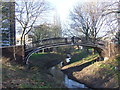
Vignoles bridge, Coventry
This iron footbridge contrasts with the postwar buildings which surround it. The bridge, which dates from the 1830s, originally spanned the Oxford Canal. It was moved to its current location over the River Sherbourne in around 1969 or 1970. It is designated as a Scheduled Ancient Monument.
Image: © Malc McDonald
Taken: 13 Jan 2013
0.02 miles
7
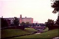
Vignoles Bridge, Spon End
A single span, cast iron former canal bridge removed here from Sowe Common during construction work for the M6 in the early 1970s and now used as a footbridge over the river Sherbourne. Cast at Horseley Iron Works, Tipton. Beyond it is Meadow Street bridge.
The building dominating the skyline is the GEC factory, formerly Rudge-Whitworth, which was demolished in 1991.
Image: © FCG
Taken: Unknown
0.02 miles
8
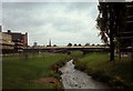
The Sherbourne at Spon End
Taken in 1972, when the area had been recently re-landscaped. The footbridge is a former canal bridge, removed here from near Sowe Common during the building of the M6. Beyond is the Ringway Rudge section of the inner ring road and the furthest building on the left was the GEC factory, previously Rudge-Whitworth and now demolished. The spire is that of Greyfriars/Christ Church, one of Coventry's three spires.
Image: © FCG
Taken: Unknown
0.02 miles
9
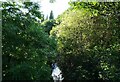
River Sherbourne
The river disappears into a culvert here, and emerges on the far side of the city centre. I couldn't see what I was photographing, in fact, because the wall is taller than I am, so I just held the camera as high as I could and hoped for the best.
Image: © Anne Burgess
Taken: 24 Sep 2021
0.03 miles
10
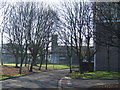
Winter sunshine, Coventry
The trees are bare and the shadows are long, indicating that this image was taken on a winter's day.
Image: © Malc McDonald
Taken: 13 Jan 2013
0.04 miles