IMAGES TAKEN NEAR TO
Betteshanger, DEAL, CT14 0NP
Introduction
This page details the photographs taken nearby to CT14 0NP by members of the Geograph project.
The Geograph project started in 2005 with the aim of publishing, organising and preserving representative images for every square kilometre of Great Britain, Ireland and the Isle of Man.

There are currently over 7.5m images from over14,400 individuals and you can help contribute to the project by visiting https://www.geograph.org.uk
Image Map
Images are licensed for reuse under creativecommons.org/licenses/by-sa/2.0
Notes
- Clicking on the map will re-center to the selected point.
- The higher the marker number, the further away the image location is from the centre of the postcode.
Image Listing (12 Images Found)
Images are licensed for reuse under creativecommons.org/licenses/by-sa/2.0
Image
Details
Distance
1
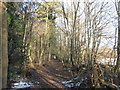
Bridleway to Betteshanger (2)
A track leads right through Lower Longlands Wood towards Betteshanger, past Northbourne Park School.
Image: © David Anstiss
Taken: 26 Dec 2010
0.08 miles
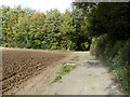
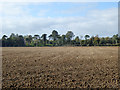
2
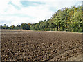
Ploughed field and woodland, Betteshanger
Image: © Robin Webster
Taken: 14 Oct 2017
0.09 miles
3
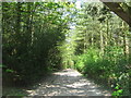
Bridleway in Admiral's Hole Wood
This track leads from Telegraph Farm towards the Northbourne Park estate.
Image: © David Anstiss
Taken: 17 Apr 2011
0.12 miles
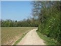
4
Bridleway towards Studdal
Just about here the track intersects the course of a mapped Roman road, and thereafter the track and then a road follow the route in a slightly distorted fashion.
Image: © Robin Webster
Taken: 14 Oct 2017
0.12 miles
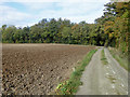
5
Bridleway to Betteshanger
This is a distorted Roman road, the straight line being a bit to the right in the wood here and crossing in the wood.
Image: © Robin Webster
Taken: 14 Oct 2017
0.13 miles
6
Bridleway to Betteshanger
This is a distorted Roman road, the straight line being a bit to the right in the wood here and crossing ahead in the wood. Thereafter the modern route veers away from the ancient one.
Image: © Robin Webster
Taken: 14 Oct 2017
0.14 miles
7
Bridleway beside Admiral's Hole Wood
A bridleway leads from Nine Acre Wood, past Telegraph Farm, and then Admiral's Hole Wood (on the right) before heading into Northbourne Park Estate in Betteshanger.
The road is on the route of a former Roman Road.
Image: © David Anstiss
Taken: 17 Apr 2011
0.14 miles
8
Bridleway to Betteshanger
A track leads from Tilmanstone, over the A256 Dover Road (dual carriageway) then through Lower Longlands Wood and then towards Northbourne Park School.
Image: © David Anstiss
Taken: 26 Dec 2010
0.15 miles
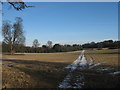
9
Cultivated field south of Betteshanger
Image: © Robin Webster
Taken: 14 Oct 2017
0.15 miles
10
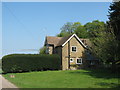
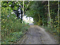
May's Cottage
Cottage in Northbourne Park Estate, beside a bridleway from Admiral's Hole Hood to Betteshanger.
Image: © David Anstiss
Taken: 17 Apr 2011
0.17 miles