
IMAGES TAKEN NEAR TO
The Glade, COULSDON, CR5 1SN
Introduction
This page details the photographs taken nearby to The Glade, CR5 1SN by members of the Geograph project.
The Geograph project started in 2005 with the aim of publishing, organising and preserving representative images for every square kilometre of Great Britain, Ireland and the Isle of Man.

There are currently over 7.5m images from over14,400 individuals and you can help contribute to the project by visiting https://www.geograph.org.uk
Image Map
Images are licensed for reuse under creativecommons.org/licenses/by-sa/2.0
Notes
- Clicking on the map will re-center to the selected point.
- The higher the marker number, the further away the image location is from the centre of the postcode.
Image Listing (51 Images Found)
Images are licensed for reuse under creativecommons.org/licenses/by-sa/2.0
Image
Details
Distance
1
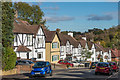
The Glade
c1930s housing in The Glade. The road is marked on the 1935 1:2,500 map, but without any housing shown at this, its lower end.
Image: © Ian Capper
Taken: 27 Oct 2018
0.10 miles
2
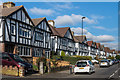
Court Avenue
1930s housing in Court Avenue. The road is marked on the 1935 1:2,500 map, with some development shown.
Image: © Ian Capper
Taken: 27 Oct 2018
0.10 miles
3
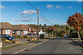
Keston Avenue
c1950s bungalows in Keston Avenue. The road is marked on the 1935 1:2,500 map, with a small number of houses in large plots shown further down the road. By the time of the 1957-8 1:2,500 map, this section is shown as having been developed.
Image: © Ian Capper
Taken: 27 Oct 2018
0.10 miles
4
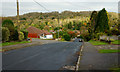
Keston Avenue, Old Coulsdon, Surrey
Looking down the hill, towards Caterham Drive.
Image: © Peter Trimming
Taken: 7 Nov 2012
0.11 miles
5
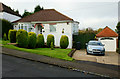
House on Keston Avenue, Old Coulsdon, Surrey
Well-designed, and well-maintained front garden.
Image: © Peter Trimming
Taken: 7 Nov 2012
0.13 miles
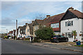
7
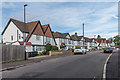
Taunton Lane
c1930s housing on Taunton Lane. These houses don't appear on the 1935 1:2,500 map but the nearby shopping parade is, suggesting development in that decade. Taunton Lane itself is much older, being shown on 19th Century maps as a country lane leading to Taunton Farm.
Image: © Ian Capper
Taken: 12 Oct 2018
0.16 miles
8
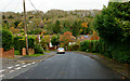
Keston Avenue, Old Coulsdon, Surrey
Looking down the hill, in the direction of Caterham Drive.
Image: © Peter Trimming
Taken: 7 Nov 2012
0.18 miles
9
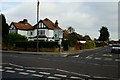
Junction of Keston Avenue and Coulsdon Road
Road junction near the centre of Old Coulsdon, Surrey.
Image: © Peter Trimming
Taken: 7 Nov 2012
0.18 miles
10
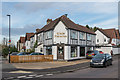
Glade Fisheries
Fish and Chip shop at the junction of The Glade and Taunton Lane.
Image: © Ian Capper
Taken: 12 Oct 2018
0.18 miles