Taunton Lane
Introduction
The photograph on this page of Taunton Lane by Ian Capper as part of the Geograph project.
The Geograph project started in 2005 with the aim of publishing, organising and preserving representative images for every square kilometre of Great Britain, Ireland and the Isle of Man.

There are currently over 7.5m images from over 14,400 individuals and you can help contribute to the project by visiting https://www.geograph.org.uk
Taunton Lane
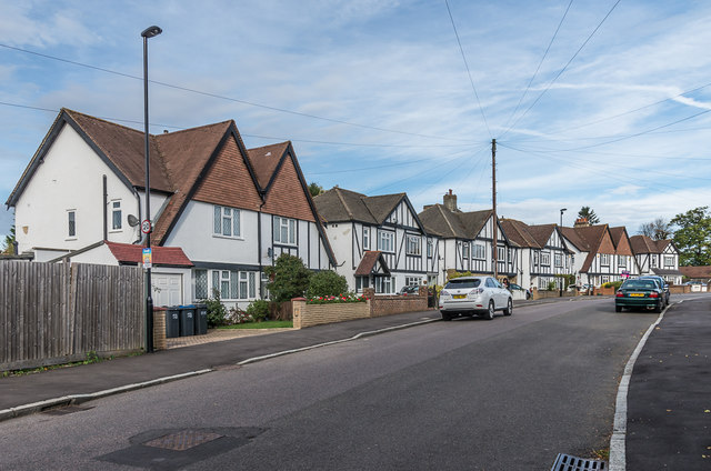
Image: © Ian Capper Taken: 12 Oct 2018
c1930s housing on Taunton Lane. These houses don't appear on the 1935 1:2,500 map but the nearby shopping parade is, suggesting development in that decade. Taunton Lane itself is much older, being shown on 19th Century maps as a country lane leading to Taunton Farm.
Images are licensed for reuse under creativecommons.org/licenses/by-sa/2.0
Image Location
Latitude
51.302544
Longitude
-0.115328