
IMAGES TAKEN NEAR TO
Chestnut Grove, MITCHAM, CR4 1RE
Introduction
This page details the photographs taken nearby to Chestnut Grove, CR4 1RE by members of the Geograph project.
The Geograph project started in 2005 with the aim of publishing, organising and preserving representative images for every square kilometre of Great Britain, Ireland and the Isle of Man.

There are currently over 7.5m images from over14,400 individuals and you can help contribute to the project by visiting https://www.geograph.org.uk
Image Map
Images are licensed for reuse under creativecommons.org/licenses/by-sa/2.0
Notes
- Clicking on the map will re-center to the selected point.
- The higher the marker number, the further away the image location is from the centre of the postcode.
Image Listing (31 Images Found)
Images are licensed for reuse under creativecommons.org/licenses/by-sa/2.0
Image
Details
Distance
1
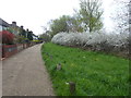
Commonside East, Mitcham Common
Mitcham Common was once a much larger area of common pasture. The subsequent survival of the Common was helped by the division between four manors. As the boundaries were unclear, no single lord was emboldened to try to control the whole Common. In the early 19th century, gravel winning began in earnest. It became such a problem with gravel pits being started all over the Common that Mitcham Common was protected under the Metropolitan Commons Act of 1891. With the acquisition of mineral rights from the lords of the manors in 1894, the Conservators of Mitcham Common were able to bring the practice of gravel digging to an end. However, the tipping of domestic refuse on Mitcham Common dramatically altered the previously flat profile of Mitcham Common by creating artificial hills. The highest of these is Mill Hill (named after the nearby former windmill) which was completed in 1960 and subsequently landscaped.
Image: © Marathon
Taken: 29 Mar 2017
0.11 miles
2
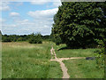
Public footpath, Mitcham Common
This runs along the edge of the common, separated from a residential area to the right by a tree belt, a ditch and a fence, with occasional access points. One is just ahead.
Image: © Robin Webster
Taken: 1 Jul 2011
0.12 miles
3
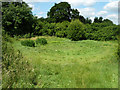
Dry pond, Mitcham Common
It seems to have been a long time since there was enough dampness here to sustain many moisture loving plants.
Image: © Robin Webster
Taken: 1 Jul 2011
0.16 miles
4
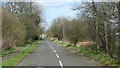
Watneys Road, Mitcham Common
I'm standing in the middle of the road, without a care in the world. Some years ago, both ends of the road were blocked to traffic, so this road is traffic-free.
Image: © Peter Trimming
Taken: 24 Mar 2009
0.18 miles
5
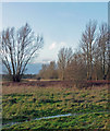
Mitcham Common (3)
The path in front has been saturated by prolonged recent rain.
Image: © Stephen Richards
Taken: 2 Jan 2014
0.19 miles
6
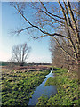
Waterlogged path, Mitcham Common
Due to prolonged recent rain.
Image: © Stephen Richards
Taken: 2 Jan 2014
0.20 miles
7
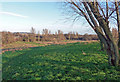
Mitcham Common (2)
Faintly visible on the far left is the TV mast at Crystal Palace.
Image: © Stephen Richards
Taken: 2 Jan 2014
0.21 miles
8
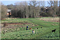
Dogs on the Common
The northern edge of Mitcham Common. A man out for a walk with seven dogs. These three came charging towards me but stopped in their tracks when he shouted. I was impressed, and not a little relieved.
Image: © Des Blenkinsopp
Taken: 11 Feb 2020
0.21 miles
9
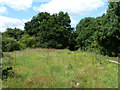
Mound, Mitcham Common
This has never been mapped, but on aerial photographs it seems to be there in 1946 in a mature state.
Image: © Robin Webster
Taken: 1 Jul 2011
0.21 miles
10
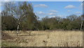
Mitcham Common
Common land; typical of how flat Mitcham Common was, prior to landscaping.
Image: © Peter Trimming
Taken: 24 Mar 2009
0.21 miles