IMAGES TAKEN NEAR TO
Meadway, WIRRAL, CH60 8PH
Introduction
This page details the photographs taken nearby to Meadway, CH60 8PH by members of the Geograph project.
The Geograph project started in 2005 with the aim of publishing, organising and preserving representative images for every square kilometre of Great Britain, Ireland and the Isle of Man.

There are currently over 7.5m images from over14,400 individuals and you can help contribute to the project by visiting https://www.geograph.org.uk
Image Map
Images are licensed for reuse under creativecommons.org/licenses/by-sa/2.0
Notes
- Clicking on the map will re-center to the selected point.
- The higher the marker number, the further away the image location is from the centre of the postcode.
Image Listing (27 Images Found)
Images are licensed for reuse under creativecommons.org/licenses/by-sa/2.0
Image
Details
Distance
1
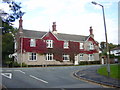
White Lodge Cottage, Village road, Heswall
White Lodge Cottage, Village road, Heswall, resplendent in its autumnal coat of virginia creeper.
Image: © Sue Adair
Taken: 22 Oct 2005
0.08 miles
2

Leading To
Hinderton Drive junction with Gayton Road.
Image: © J Scott
Taken: 20 Oct 2010
0.10 miles
3
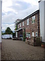
Sandstone cottage, Lower Village, Heswall
A cottage built of local red sandstone in Lower Village, Heswall. The River Dee and North Wales in the distance.
Image: © Sue Adair
Taken: 22 Oct 2005
0.13 miles
4

Gated Community
Entrance to Lapwing Rise off Gayton Road. Gated community on former site of the Victoria Hotel.
Image: © J Scott
Taken: 20 Oct 2010
0.13 miles
5

Wet Clouds
Gayton Road approaching Hinderton Drive (right hand side of road) opposite Victoria Avenue (beyond tree).
Image: © J Scott
Taken: 20 Oct 2010
0.13 miles
6
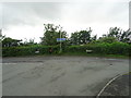
Road junction at the bottom of Station Road
The Wirral Way has to leave the former railway track as the station areas were sold separately for housing developments.
Image: © John M
Taken: 10 Jun 2017
0.14 miles
7
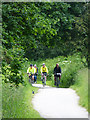
The Wirral Way at Lower Heswall
The railway from Hooton to West Kirby, a branch of the Birkenhead Railway was opened in 1886, closed in 1962. In 1973, the whole length of the old railway was designated as the "Wirral Way", part of the Wirral Country Park, a traffic-free route for walkers. Use of the path was subsequently extended to cyclists and horse-riders.
This section of the Wirral Way is designated National Route 568 of the National Cycle Network and follows the eastern shore of the Dee Estuary from Leasowe to Chester.
Image: © Oliver Dixon
Taken: 4 Jun 2014
0.14 miles
8
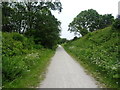
The Wirral Way, Wirral Country park
Looking north west on a disused railway.
Image: © JThomas
Taken: 25 May 2019
0.16 miles
9
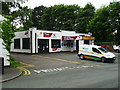
Lower Village Garage
Garage on Village Road, Heswall.
Image: © John M
Taken: 10 Jun 2017
0.17 miles