IMAGES TAKEN NEAR TO
Garden Lane, CHESTER, CH1 4EU
Introduction
This page details the photographs taken nearby to Garden Lane, CH1 4EU by members of the Geograph project.
The Geograph project started in 2005 with the aim of publishing, organising and preserving representative images for every square kilometre of Great Britain, Ireland and the Isle of Man.

There are currently over 7.5m images from over14,400 individuals and you can help contribute to the project by visiting https://www.geograph.org.uk
Image Map
Images are licensed for reuse under creativecommons.org/licenses/by-sa/2.0
Notes
- Clicking on the map will re-center to the selected point.
- The higher the marker number, the further away the image location is from the centre of the postcode.
Image Listing (1596 Images Found)
Images are licensed for reuse under creativecommons.org/licenses/by-sa/2.0
Image
Details
Distance
1
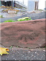
Weathered bench mark in Garden Lane, Chester
This Ordnance Survey bench mark is close to the entrance to Garden Lane car park, close to the St Martin's Way flyover. The sandstone used to be the garden wall of a detached house, which was demolished when the flyover was built in the 1960s. See also Image
Image: © John S Turner
Taken: 20 Nov 2018
0.01 miles
2
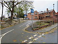
Garden Lane Car Park, Chester
The access ramp to Garden Lane Car Park, which is below the St Martin's Way flyover. Prior to the building of the flyover the site had a large detached house behind what remains of the low sandstone wall. There is a weathered Ordnance Survey bench mark on the sandstone below the 'Except Cycles' road sign -Image
Image: © John S Turner
Taken: 20 Nov 2018
0.01 miles
3
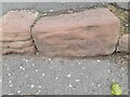
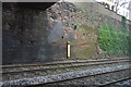
Ordnance Survey Cut Mark
This OS cut mark can be found on the NE side of Garden Lane. It marks a point 76.07ft above mean sea level.
Image: © Adrian Dust
Taken: 13 Sep 2022
0.01 miles
4
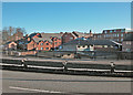
Garden Lane
Viewed from inner ring road.
Image: © Dennis Turner
Taken: 23 Jan 2005
0.03 miles
5
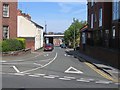
Garden Lane from Canal Street
Looking along Garden Lane from its junction with Canal Street. A short distance away the road is crossed by St Martin's Way, the city's inner ring road.
Image: © John S Turner
Taken: 8 Jun 2008
0.03 miles
7
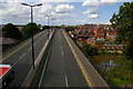
Chester: St Martin's Way
A dual carriageway swooping across the canal and smashing through the city walls, where the resulting concrete footbridge is coyly named "St Martin's Gate". The 1960s really were another era in terms of what could get through planning.
Image: © Christopher Hilton
Taken: 16 Aug 2012
0.04 miles
8
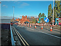
Elevated ring road
The start of road works to strengthen parts of the elevated section of the City's inner ring road. Although originally scheduled to take only a few months version three of the road works has only recently been completed.
Image: © Dennis Turner
Taken: 13 Oct 2005
0.04 miles
9
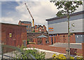
Store corner
A group of stores to the north east of the Fountains roundabout. In the centre of the picture is the former Abbeygate School which was badly damaged by fire in May 2008. Behind the wall in the near centre is a railway cutting carrying the main line to Holyhead and a railway tunnel.
Image: © Dennis Turner
Taken: 3 Jun 2008
0.04 miles