
IMAGES TAKEN NEAR TO
Chapel Street, TREORCHY, CF42 5EA
Introduction
This page details the photographs taken nearby to Chapel Street, CF42 5EA by members of the Geograph project.
The Geograph project started in 2005 with the aim of publishing, organising and preserving representative images for every square kilometre of Great Britain, Ireland and the Isle of Man.

There are currently over 7.5m images from over14,400 individuals and you can help contribute to the project by visiting https://www.geograph.org.uk
Image Map
Images are licensed for reuse under creativecommons.org/licenses/by-sa/2.0
Notes
- Clicking on the map will re-center to the selected point.
- The higher the marker number, the further away the image location is from the centre of the postcode.
Image Listing (29 Images Found)
Images are licensed for reuse under creativecommons.org/licenses/by-sa/2.0
Image
Details
Distance
1
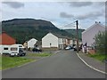
Hendrewen Road
The last (first?) houses in Blaencwm.
Image: © Alan Hughes
Taken: 8 Aug 2019
0.02 miles
2
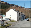
Chapel Street, Blaencwm
Chapel Street houses viewed from the Michael's Road side. There is no longer a chapel on Chapel Street. The nearest places of worship are about a kilometre to the east, in Tynewydd.
Image: © Jaggery
Taken: 23 Mar 2011
0.02 miles
3
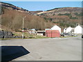
Scenic view from Michael's Road, Blaencwm
Wooded hillsides surround Blaencwm, located at the head the Rhondda Fawr valley.
This view is NNE from Michael's Road looking past Chapel Street houses.
Image: © Jaggery
Taken: 23 Mar 2011
0.02 miles
4
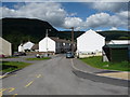
Part of the top end of Blaencwm
A retired couple sit on a bench in the sun, presumably local residents, judging by their Rhondda accents and their friendly comments as I passed. I bet they've seen some changes locally in their lifetimes.
Image: © Jeremy Bolwell
Taken: 30 Jun 2011
0.03 miles
5
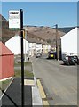
Michael's Road bus stop, Blaencwm
The bus stop is at the edge of a turning circle at the end of route 120 to and from Caerphilly via Tonypandy and Pontypridd. The sign shows that on Sundays, the stop is served by route 130 to and from Porth via Tonypandy.
Ahead are houses on Michael's Road.
Image: © Jaggery
Taken: 23 Mar 2011
0.04 miles
6
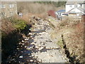
Nant Selsig, Blaencwm
A rock-strewn stream viewed from the eastern side of Delwen Terrace.
Image: © Jaggery
Taken: 23 Mar 2011
0.04 miles
7
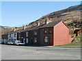
Hendrewen Road, Blaencwm
Houses viewed from the corner of Delwen Terrace and Michael's Road.
Image: © Jaggery
Taken: 23 Mar 2011
0.04 miles
8
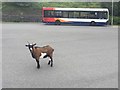
Blaencwm bus terminus
My hill-walking companion or just the end of the road for this goat?
Image: © Alan Hughes
Taken: 8 Aug 2019
0.05 miles
9
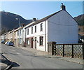
Michael's Road, Blaencwm
Houses on the north side of Michael's Road.
Image: © Jaggery
Taken: 23 Mar 2011
0.06 miles
10

Blaencwm from above
The village looks very little in the valley bottom below.
Image: © Jeremy Bolwell
Taken: 30 Jun 2011
0.07 miles