1
Cycle track on National Cycle Route 4, Kenfig Hill
National Cycle Route 4 passes along both a cycle track and stretches of road at Kenfig Hill. It’s seen here part way along the off-road track, which is approximately 600 metres long. This well-wooded track runs along part of the route once taken by the Dyffryn Llynfi & Porthcawl Railway.
Image: © eswales
Taken: 15 Jun 2022
0.05 miles
2
National Cycle Route 4 amid tall trees at Kenfig Hill
The long distance cycle route seen on an off-road section where it runs along the course of the former Dyffryn Llynfi & Porthcawl Railway.
Image: © eswales
Taken: 15 Jun 2022
0.08 miles
3
Public footpath at the northern edge of Kenfig Hill (2)
Looking back towards the eastern end of the public footpath which runs in broadleaf woodland at the northern edge of Kenfig Hill.
Image: © eswales
Taken: 15 Jun 2022
0.09 miles
4
Public footpath at the northern edge of Kenfig Hill
Heading off through woodland on a concrete walkway from the western end of New Road.
Image: © eswales
Taken: 15 Jun 2022
0.10 miles
5
Hawker Hunter
This Hawker Hunter is in the grounds of 2117 (Kenfig Hill) Squadron, Air Training Corps
Image: © John Finch
Taken: 10 Nov 2011
0.11 miles
6
Footpath in woodland at Kenfig Hill
The image shows part of a concrete walkway which runs from the western end of New Road to a point on National Cycle Route 4 a short distance behind the camera. It is (part of) a public footpath for much of its length although at this stage, maps suggest, does not have that status.
Image: © eswales
Taken: 15 Jun 2022
0.11 miles
7
Millennium milepost beside National Cycle Route 4, Kenfig Hill
A millennium milepost of the Fossil Tree design indicates that from this spot it is two miles to Cefn Cribwr and six to Margam.
Image: © eswales
Taken: Unknown
0.12 miles
8
Public footpath at the northern edge of Kenfig Hill (3)
Having run westwards along a concrete walkway for a short distance the public footpath departs from it to run as a path of flattened earth towards its destination of Waterhall Road.
Image: © eswales
Taken: 15 Jun 2022
0.13 miles
9
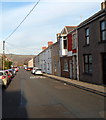
Evans Street, Kenfig Hill
Viewed from the Pwllygath Street end.
Image: © Jaggery
Taken: 29 Nov 2012
0.14 miles
10
Four modern houses on the south side of Prince Road, Kenfig Hill
Viewed from the edge of Y Brynddu pub. http://www.geograph.org.uk/photo/3262789 The houses were built c2007.
Image: © Jaggery
Taken: 29 Nov 2012
0.14 miles


