IMAGES TAKEN NEAR TO
Tirril, PENRITH, CA10 2LS
Introduction
This page details the photographs taken nearby to CA10 2LS by members of the Geograph project.
The Geograph project started in 2005 with the aim of publishing, organising and preserving representative images for every square kilometre of Great Britain, Ireland and the Isle of Man.

There are currently over 7.5m images from over14,400 individuals and you can help contribute to the project by visiting https://www.geograph.org.uk
Image Map
Images are licensed for reuse under creativecommons.org/licenses/by-sa/2.0
Notes
- Clicking on the map will re-center to the selected point.
- The higher the marker number, the further away the image location is from the centre of the postcode.
Image Listing (19 Images Found)
Images are licensed for reuse under creativecommons.org/licenses/by-sa/2.0
Image
Details
Distance
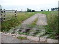
2
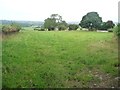
Farmland at Celleron
Looking north from the road junction.
Image: © Christine Johnstone
Taken: 26 Sep 2015
0.05 miles
3
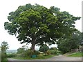
Roadside tree, Celleron
What came first, the junction or the tree?
Image: © Christine Johnstone
Taken: 26 Sep 2015
0.06 miles
4
![Township boundary post, near Celleron [north side]](https://s2.geograph.org.uk/geophotos/04/69/23/4692346_7a1fb690_120x120.jpg)
Township boundary post, near Celleron [north side]
Image: © Christine Johnstone
Taken: 26 Sep 2015
0.06 miles
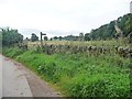
5
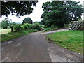
Road Junction at Celleron
First left to a farm, second left to Askham. Right to Pooley Bridge, behind me the lane to Thorpe
Image: © Martin Dawes
Taken: 17 May 2012
0.07 miles
6
![Township boundary post, near Celleron [south side]](https://s2.geograph.org.uk/geophotos/04/69/23/4692342_5ca50852_120x120.jpg)
Township boundary post, near Celleron [south side]
Image: © Christine Johnstone
Taken: 26 Sep 2015
0.07 miles
7
This way to Celleron
Private track to both North Celleron and South Celleron Farms.
Image: © Christine Johnstone
Taken: 26 Sep 2015
0.07 miles
8
Public footpath signpost, Celleron
The path runs south towards High Winder.
Image: © Christine Johnstone
Taken: 26 Sep 2015
0.08 miles
9
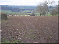
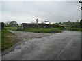
Farmland at Celleron
Unusually in this area, the sheep are not grazing, but being fed roots.
Image: © Bob Jenkins
Taken: 26 Jan 2006
0.09 miles
10
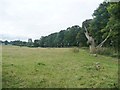
Public footpath towards High Winder
Running along the eastern boundary of Broadrim Wood.
Image: © Christine Johnstone
Taken: 26 Sep 2015
0.09 miles