
IMAGES TAKEN NEAR TO
De Wind Drive, NEWTOWNARDS, BT23 5BJ
Introduction
This page details the photographs taken nearby to De Wind Drive, BT23 5BJ by members of the Geograph project.
The Geograph project started in 2005 with the aim of publishing, organising and preserving representative images for every square kilometre of Great Britain, Ireland and the Isle of Man.

There are currently over 7.5m images from over14,400 individuals and you can help contribute to the project by visiting https://www.geograph.org.uk
Image Map
Images are licensed for reuse under creativecommons.org/licenses/by-sa/2.0
Notes
- Clicking on the map will re-center to the selected point.
- The higher the marker number, the further away the image location is from the centre of the postcode.
Image Listing (83 Images Found)
Images are licensed for reuse under creativecommons.org/licenses/by-sa/2.0
Image
Details
Distance
1
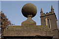
Gate pillar, St Mary's parish church, Comber
See Image This pillar stands on the right of the entrance to the church. It refers to a Thomas Andrews, the churchwarden in 1774. He is likely to have been a member of the Andrews family Image
Image: © Albert Bridge
Taken: 26 Feb 2007
0.08 miles
2
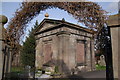
Andrews family vault, Comber
The Andrews family rose to prominence in Comber during the 18th and 19th centuries. The family might have come from Scotland in the 17th century. The descendants had interests in a number of trades including milling, distilling and linen. This is the family vault at St Mary's parish church Image As an aside, one of the Andrews family (Thomas) designed the “Titanic”.
Image: © Albert Bridge
Taken: 26 Feb 2007
0.08 miles
3
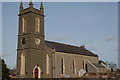
St Mary's church, Comber
St Mary’s (CoI), Comber is another of the churches built on the site of an old abbey. In this case it was the Cistercian abbey of St Mary’s built in 1199 and destroyed by fire in 1572. The present church was built in 1623 although various bits and pieces have since been added. It lies to the east of The Square.
Image: © Albert Bridge
Taken: 26 Feb 2007
0.08 miles
5
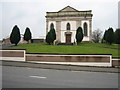
Second Comber Presbyterian Church
This building dates from 1839.
Image: © Brian Shaw
Taken: 15 Mar 2006
0.08 miles
6
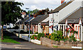
Lower Crescent, Comber
A street to the north of Bridge Street and the Newtownards Road. Sheltered from both by a line of trees (left).
Image: © Albert Bridge
Taken: 11 Sep 2010
0.09 miles
7
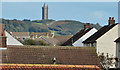
Rooftops, Comber
One of the side effects of Comber’s position among the drumlins of north Down is the chance to see the rooftops without recourse to a “cherry picker”. This view is from De Wind Drive, across the Newtownards Road, towards Scrabo Tower http://www.geograph.org.uk/snippet/7476.
Image: © Albert Bridge
Taken: 23 Oct 2013
0.10 miles
8
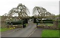
Weeping willows at the entrance to Comber Cemetery
Image: © Eric Jones
Taken: 22 Apr 2017
0.10 miles
9
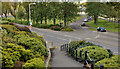
Bridge Street, Comber (2)
Although built mainly on the flat ground close to the shore of Strangford Lough there are some higher places in Comber. This view shows Bridge Street from the relative heights of De Wind Drive.
Image: © Albert Bridge
Taken: 15 May 2012
0.10 miles
10
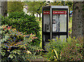
Telephone box, Comber
A telephone box, among the shrubs at Bridge Street and Lower Crescent. It can also be seen in the background in Image
Image: © Albert Bridge
Taken: 15 May 2012
0.10 miles