
IMAGES TAKEN NEAR TO
Albert Street, BELFAST, BT12 4HB
Introduction
This page details the photographs taken nearby to Albert Street, BT12 4HB by members of the Geograph project.
The Geograph project started in 2005 with the aim of publishing, organising and preserving representative images for every square kilometre of Great Britain, Ireland and the Isle of Man.

There are currently over 7.5m images from over14,400 individuals and you can help contribute to the project by visiting https://www.geograph.org.uk
Image Map
Images are licensed for reuse under creativecommons.org/licenses/by-sa/2.0
Notes
- Clicking on the map will re-center to the selected point.
- The higher the marker number, the further away the image location is from the centre of the postcode.
Image Listing (201 Images Found)
Images are licensed for reuse under creativecommons.org/licenses/by-sa/2.0
Image
Details
Distance
1
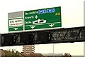
Gantry sign, Belfast
See Image The gantry sign seen in the previous photograph.
Image: © Albert Bridge
Taken: 14 Sep 2009
0.10 miles
2
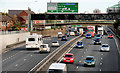
The Westlink, Grosvenor Road, Belfast
Traffic flowing freely on the Westlink, looking towards the M2 at the Grosvenor Road. Since the building of the flyover Image queues tend to be limited to peaks and can usually be attributed to the absence of a flyover at York Street Image
Image: © Albert Bridge
Taken: 24 Sep 2010
0.10 miles
3
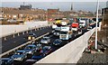
The Westlink, Belfast (9)
See Image Two lanes of the underpass are now open in each direction. The old temporary alignment of the Grosvenor Road is on the right although hardly recognisable. The scheme includes another underpass at Broadway on the Donegall Road and the widening of the Broadway – Stockman’s Lane section of the M1 to three lanes – while keeping the road open for all traffic. The overall completion date is currently given as March 2009. In the meantime queues such as this are common throughout the working day.
Image: © Albert Bridge
Taken: 4 Feb 2008
0.10 miles
4
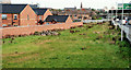
Westlink grass, Belfast
A grassed area between the houses off the Cullingtree Road (left) and the Westlink Image It came about after the replacement of the Grosvenor Road roundabout by a flyover Image The absence of landscaping could generate a conspiracy theory that it might become a northbound sliproad at some future date.
Image: © Albert Bridge
Taken: 24 Sep 2010
0.10 miles
5
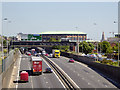
Belfast, Westlink (A12)
The Westlink road in Belfast, is a dual carriageway throughpass, designated the A12, connecting the M1 to the M2 and M3 motorways which run south, north and east of the city, respectively. This view is from Grosvenor Road.
Image: © David Dixon
Taken: 26 May 2017
0.10 miles
6
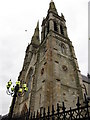
A side view of the twin spires of St Peter's Catholic Cathedral
Image: © Eric Jones
Taken: 20 May 2012
0.11 miles
7
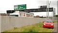
The Westlink, Belfast (2)
See Image Much of the Westlink is in a cutting. Where it is not it mostly has a high safety wall. Traffic (except for high-sided vehicles) can pass unseen but not unheard. This is the section (looking towards the M2) at Willow Street.
Image: © Albert Bridge
Taken: 14 Sep 2009
0.11 miles
8
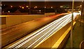
The Westlink, Belfast
See Image For the record – the rebuilt Westlink officially opened (with three lanes in each direction from Divis Street to Broadway) on 1 December 2008 although in practice it was fully open on 29 November. The target completion date was March 2009. At 17.27 today the peak traffic was flowing freely. The view is from the overbridge at the Grosvenor Road towards the M2. Image shows an off-peak view, during the construction work, in February 2008.
Image: © Albert Bridge
Taken: 11 Dec 2008
0.11 miles
9
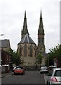
The rear of St Peter's Catholic Cathedral
Image: © Eric Jones
Taken: 20 May 2012
0.11 miles
10
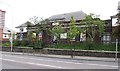
St Comgall's Primary School, Divis Street
Image: © Eric Jones
Taken: 20 May 2012
0.11 miles