The Westlink, Belfast (2)
Introduction
The photograph on this page of The Westlink, Belfast (2) by Albert Bridge as part of the Geograph project.
The Geograph project started in 2005 with the aim of publishing, organising and preserving representative images for every square kilometre of Great Britain, Ireland and the Isle of Man.

There are currently over 7.5m images from over 14,400 individuals and you can help contribute to the project by visiting https://www.geograph.org.uk
The Westlink, Belfast (2)
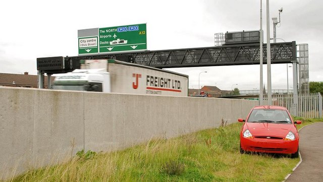
Image: © Albert Bridge Taken: 14 Sep 2009
See Image Much of the Westlink is in a cutting. Where it is not it mostly has a high safety wall. Traffic (except for high-sided vehicles) can pass unseen but not unheard. This is the section (looking towards the M2) at Willow Street.
Images are licensed for reuse under creativecommons.org/licenses/by-sa/2.0
Image Location
Latitude
54.597055
Longitude
-5.940764