1
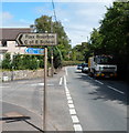
Left turn for Station Road and the C of E school, Flax Bourton
Viewed along the A370 Main Road. The blue sign pointing left shows cycle route distances.
It's 2¼ (miles) to Long Ashton, 2½ to Nailsea and to Backwell.
Image: © Jaggery
Taken: 13 Jul 2012
0.02 miles
2
Old School House, Flax Bourton
The modernised house on the corner of Main Road and Station Road is named Old School House.
Image: © Jaggery
Taken: 13 Jul 2012
0.02 miles
3
Ordnance Survey Flush Bracket (G2265)
This OS Flush Bracket can be found on the old school north side of the road. It marks a point 35.975m above mean sea level.
Image: © Adrian Dust
Taken: 24 Aug 2022
0.05 miles
4
Parish notice boards
A pair of notice boards, similar to a couple opposite the church of St Michael and All Angels. Presumably the notices are copies.
Image: © Neil Owen
Taken: 24 Mar 2014
0.06 miles
5
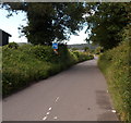
Station Road, Flax Bourton
Looking north from the Main Road end. For more than a century, the village had a railway station.
The first one opened in 1860. It was replaced by a larger station in 1893.
Passenger services in this area ceased in December 1963.
Image: © Jaggery
Taken: 13 Jul 2012
0.07 miles
6
Orchard Close, Flax Bourton
Houses in a cul-de-sac on the east side of Station Road.
Image: © Jaggery
Taken: 13 Jul 2012
0.10 miles
7
Bare Tree
On the outskirts of Flax Bourton
Image: © Adrian and Janet Quantock
Taken: 25 Feb 2006
0.12 miles
8
Field, Flax Bourton
A tarmac footpath provides a safe alternative to walking along Station Road, which runs parallel to the left. On the right is
Image, which has lost a good deal of its height in just over four years.
Image: © Derek Harper
Taken: 23 May 2010
0.13 miles
9
Flax Bourton Church of England Primary School
Viewed from Station Road.
Image: © Jaggery
Taken: 13 Jul 2012
0.13 miles
10
Narrow part of Station Road, Flax Bourton
The road here is not wide enough for pavements, but there is a path http://www.geograph.org.uk/photo/3715677 parallel with the road, behind the hedge on the right.
Image: © Jaggery
Taken: 13 Jul 2012
0.16 miles


