
IMAGES TAKEN NEAR TO
Goddington Lane, ORPINGTON, BR6 9DZ
Introduction
This page details the photographs taken nearby to Goddington Lane, BR6 9DZ by members of the Geograph project.
The Geograph project started in 2005 with the aim of publishing, organising and preserving representative images for every square kilometre of Great Britain, Ireland and the Isle of Man.

There are currently over 7.5m images from over14,400 individuals and you can help contribute to the project by visiting https://www.geograph.org.uk
Image Map
Images are licensed for reuse under creativecommons.org/licenses/by-sa/2.0
Notes
- Clicking on the map will re-center to the selected point.
- The higher the marker number, the further away the image location is from the centre of the postcode.
Image Listing (51 Images Found)
Images are licensed for reuse under creativecommons.org/licenses/by-sa/2.0
Image
Details
Distance
1
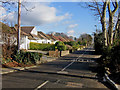
Goddington Lane, looking east
As the name "lane" suggests, Goddington Lane predates the mainly post war development here and in the surrounding roads, the lane itself appearing on the 1897 Revised New Series one inch map.
Image: © Ian Capper
Taken: 30 Jan 2008
0.02 miles
2
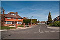
Dene Drive
A 1970s(?) cul-de-sac off Goddington Lane. The house on the left predates the road: no 61 Goddington Lane, a locally listed house dating from 1898.
Image: © Ian Capper
Taken: 6 Apr 2011
0.05 miles
3
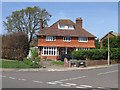
Goddington Lane
No 61, a locally listed house dating from 1898, at the point where Dene Drive meets Goddington Lane.
Image: © Ian Capper
Taken: 22 Apr 2009
0.05 miles
4
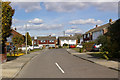
Dene Drive
A 1970s(?) cul-de-sac off Goddington Lane.
Image: © Ian Capper
Taken: 15 Mar 2010
0.06 miles
5
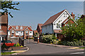
Abbey Close
A 2008 gated development off Charterhouse Road.
Image: © Ian Capper
Taken: 22 May 2012
0.06 miles
6
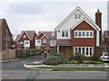
Abbey Close
A 2008 gated development off Charterhouse Road. Most of the roads in this part of Orpington are named after public schools - however, although there are various Abbey Schools in the UK, the name isn't as instantly recognisable as most of the others in the area.
Image: © Ian Capper
Taken: 11 Feb 2009
0.06 miles
7
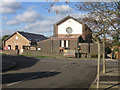
Christ Church
This church, in the "schools" district of Orpington (most of the roads in the area are named after public schools), was built in 1940 and refurbished in 2006, including the building of a new hall (the building to the left of the picture).
Image: © Ian Capper
Taken: 30 Jan 2008
0.08 miles
8
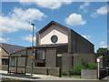
Christchurch Orpington
On Charterhouse Road, opposite Malvern Road.
Image: © David Anstiss
Taken: 24 Jul 2011
0.08 miles
9
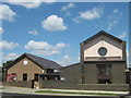
Christchurch Orpington and Church Hall
On Charterhouse Road, opposite Malvern Road.
Image: © David Anstiss
Taken: 24 Jul 2011
0.09 miles
10
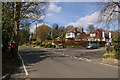
Junction of Goddington Lane with Wyvern Close
Goddington Lane was before the development of this area an old country lane, already shown on early 19th century maps. In the background on the left can be seen a Coal Tax Post (see Image).
Image: © Ian Capper
Taken: 15 Mar 2010
0.09 miles