
IMAGES TAKEN NEAR TO
Court Road, ORPINGTON, BR6 9BZ
Introduction
This page details the photographs taken nearby to Court Road, BR6 9BZ by members of the Geograph project.
The Geograph project started in 2005 with the aim of publishing, organising and preserving representative images for every square kilometre of Great Britain, Ireland and the Isle of Man.

There are currently over 7.5m images from over14,400 individuals and you can help contribute to the project by visiting https://www.geograph.org.uk
Image Map
Images are licensed for reuse under creativecommons.org/licenses/by-sa/2.0
Notes
- Clicking on the map will re-center to the selected point.
- The higher the marker number, the further away the image location is from the centre of the postcode.
Image Listing (50 Images Found)
Images are licensed for reuse under creativecommons.org/licenses/by-sa/2.0
Image
Details
Distance
1
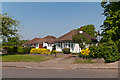
Court Road
Bungalows in Court Road by its junction with Goddington Lane.
Image: © Ian Capper
Taken: 22 May 2012
0.05 miles
2
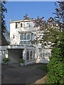
House in Court Road
This house stands out in total contrast to the typical interwar/postwar houses and bungalows that otherwise line the A224 Orpington bypass.
Image: © Ian Capper
Taken: 6 May 2008
0.06 miles
3
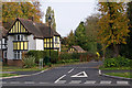
Hurstlands Drive
See Image Work on the site restarted in late 2009/early 2010, following a year's break, and the new development, called Hurstlands Drive, completed in October 2010 - see Image for photo.
Image: © Ian Capper
Taken: 3 Nov 2010
0.09 miles
4
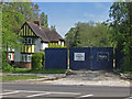
Work stopped
Housing development in Court Road. Planning permission was granted in 2007, with an amendment agreed in 2008, for the demolition of one house to give access to land behind for six new houses. Work started but then late in 2008 abruptly halted (see Image). A victim of the credit crunch?
Post script - see Image and Image for subsequent completion of the development.
Image: © Ian Capper
Taken: 22 Apr 2009
0.09 miles
5
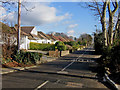
Goddington Lane, looking east
As the name "lane" suggests, Goddington Lane predates the mainly post war development here and in the surrounding roads, the lane itself appearing on the 1897 Revised New Series one inch map.
Image: © Ian Capper
Taken: 30 Jan 2008
0.10 miles
6
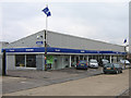
Parkside Volvo
Volvo main dealer in Court Road
Image: © Ian Capper
Taken: 11 Feb 2009
0.10 miles
7
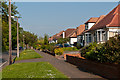
Goddington Lane
Goddington Lane is an old lane, now split in two parts by the Orpington Bypass. These bungalows, dating from the 1950s or so, are in the eastern leg.
Image: © Ian Capper
Taken: 22 May 2012
0.10 miles
8
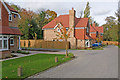
Hurstlands Drive
Backgarden development off Court Road. See Image for a photo of the development in early 2009, some time after work had stopped, not restarting for over a year.
Image: © Ian Capper
Taken: 3 Nov 2010
0.10 miles
9
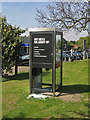
... and glaziers
Vandalised phone box in Court Road. The advertisement is for army recruits.
Image: © Ian Capper
Taken: 22 Apr 2009
0.11 miles
10
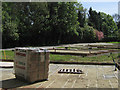
Work stopped
See Image for background to this development in Court Road. It can be seen here that the footings were completed, at which point work abruptly stopped. The pile of bricks would suggest an active building site, whereas in fact no work has been done for over four months.
Image: © Ian Capper
Taken: 22 Apr 2009
0.11 miles