
IMAGES TAKEN NEAR TO
Woodcote Drive, ORPINGTON, BR6 8DT
Introduction
This page details the photographs taken nearby to Woodcote Drive, BR6 8DT by members of the Geograph project.
The Geograph project started in 2005 with the aim of publishing, organising and preserving representative images for every square kilometre of Great Britain, Ireland and the Isle of Man.

There are currently over 7.5m images from over14,400 individuals and you can help contribute to the project by visiting https://www.geograph.org.uk
Image Map
Images are licensed for reuse under creativecommons.org/licenses/by-sa/2.0
Notes
- Clicking on the map will re-center to the selected point.
- The higher the marker number, the further away the image location is from the centre of the postcode.
Image Listing (99 Images Found)
Images are licensed for reuse under creativecommons.org/licenses/by-sa/2.0
Image
Details
Distance
1
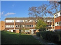
Housing diversity (Place Farm Estate)
A series of photos showing the diversity of housing in one gridsquare in outer suburbia. For others in series see http://www.geograph.org.uk/search.php?i=1905481. Any further information, such as building dates and what was on the sites before building, would be appreciated.
These blocks lie between Woodcote Drive and Place Farm Avenue, part of the Place Farm Estate, built in the 1970s (?). Only a small part of this high density estate is in this gridsquare, the remainder being in Image
Image: © Ian Capper
Taken: 21 Nov 2007
0.02 miles
4
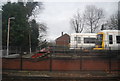
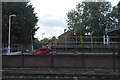
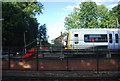
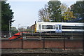
Trains in the siding, near Orpington Station
Image: © N Chadwick
Taken: 25 Feb 2011
0.06 miles
5

Footpath near Place Farm Avenue
The footpath runs between the railway and a housing estate, but doesn't offer much of a view of either.
Image: © Bill Boaden
Taken: 10 Oct 2015
0.07 miles
8
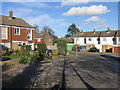
Housing diversity (Red Cedars Road and Claywood Close)
A series of photos showing the diversity of housing in one gridsquare in outer suburbia. For others in series see http://www.geograph.org.uk/search.php?i=1905481. Any further information, such as building dates and what was on the sites before building, would be appreciated.
Red Cedars Road and Claywood Close, a 1960s (?) development off Dale Wood Road filling a space between that road and the railway.
Image: © Ian Capper
Taken: 21 Nov 2007
0.08 miles
9
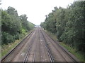
Petts Wood: South Eastern Main Line
Although this railway now forms the South Eastern Main Line, this particular section was a latecomer, only being constructed by the South Eastern Railway and opening in 1868. This is the view from the separate footbridge on the south side of the Crofton Lane road bridge over the railway. In the far distance is Orpington station in Image
Image: © Nigel Cox
Taken: 22 Sep 2013
0.09 miles
10
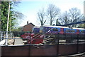
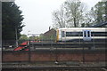
Trains in a siding north of Orpington Station
Image: © N Chadwick
Taken: 9 Apr 2011
0.10 miles