
IMAGES TAKEN NEAR TO
Chislehurst Road, ORPINGTON, BR6 0DW
Introduction
This page details the photographs taken nearby to Chislehurst Road, BR6 0DW by members of the Geograph project.
The Geograph project started in 2005 with the aim of publishing, organising and preserving representative images for every square kilometre of Great Britain, Ireland and the Isle of Man.

There are currently over 7.5m images from over14,400 individuals and you can help contribute to the project by visiting https://www.geograph.org.uk
Image Map
Images are licensed for reuse under creativecommons.org/licenses/by-sa/2.0
Notes
- Clicking on the map will re-center to the selected point.
- The higher the marker number, the further away the image location is from the centre of the postcode.
Image Listing (73 Images Found)
Images are licensed for reuse under creativecommons.org/licenses/by-sa/2.0
Image
Details
Distance
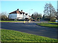
2
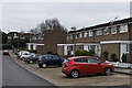
Cowden Road
Part of the Sandycroft Estate built around 1970 between Crofton Lane and Chislehurst Road on the site of a former orchard of the same name.
Image: © Ian Capper
Taken: 19 Mar 2013
0.06 miles
3
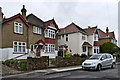
Chislehurst Road
1920s housing on Chislehurst Road.
Image: © Ian Capper
Taken: 19 Mar 2013
0.06 miles
4
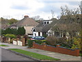
Housing diversity (Cambray Road)
A series of photos showing the diversity of housing in one gridsquare in outer suburbia. For others in series see http://www.geograph.org.uk/search.php?i=1905481. Any further information, such as building dates and what was on the sites before building, would be appreciated.
Cambray Road, which the 1940 1 inch map at http://www.npemap.org.uk/tiles/map.html#546,166,1 shows as a close off Chislehurst Road, with the 1970 1 inch map showing as having an extension at the foot along the line of the current Perry Hall Road, which since then has been widened to form a replacement main A208 Orpington to Chislehurst road, with Cambray Road forming a link between the old and new roads.
Image: © Ian Capper
Taken: 23 Nov 2007
0.07 miles
5
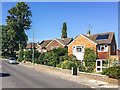
Chislehurst Road
Late 1950s or early 1960s housing built in the grounds of Perry Hall House (now Perry Hall Farmhouse - see Image) in a section of the road otherwise largely developed in the 1920s.
Image: © Ian Capper
Taken: 14 Sep 2016
0.07 miles
6
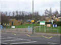
Perry Hall Primary School
Built in the 1970s, replacing two schools in Chislehurst Road (see Image).
Image: © Ian Capper
Taken: 29 Jan 2008
0.08 miles
7
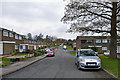
Cowden Road
Part of the Sandycroft Estate built around 1970 between Crofton Lane and Chislehurst Road on the site of a former orchard of the same name.
Image: © Ian Capper
Taken: 19 Mar 2013
0.08 miles
8
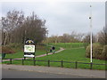
Entrance to Poverest Park from Perry Hall Road
Image: © Ian Capper
Taken: 29 Jan 2008
0.09 miles
10
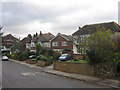
Housing diversity (Chislehurst Road)
A series of photos showing the diversity of housing in one gridsquare in outer suburbia. For others in series see http://www.geograph.org.uk/search.php?i=1905481. Any further information, such as building dates and what was on the sites before building, would be appreciated.
Chislehurst Road, which as its name suggests was once the main Orpington to Chislehurst road, before this stretch was superseded in the 1970s (?) by Perry Hall Road, slightly further to the north. The original housing here appears to be pre war, with some subsequent in filling.
Image: © Ian Capper
Taken: 23 Nov 2007
0.09 miles