IMAGES TAKEN NEAR TO
St. Johns Road, ORPINGTON, BR5 1HX
Introduction
This page details the photographs taken nearby to St. Johns Road, BR5 1HX by members of the Geograph project.
The Geograph project started in 2005 with the aim of publishing, organising and preserving representative images for every square kilometre of Great Britain, Ireland and the Isle of Man.

There are currently over 7.5m images from over14,400 individuals and you can help contribute to the project by visiting https://www.geograph.org.uk
Image Map
Images are licensed for reuse under creativecommons.org/licenses/by-sa/2.0
Notes
- Clicking on the map will re-center to the selected point.
- The higher the marker number, the further away the image location is from the centre of the postcode.
Image Listing (84 Images Found)
Images are licensed for reuse under creativecommons.org/licenses/by-sa/2.0
Image
Details
Distance
1
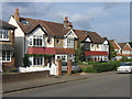
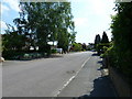
Housing diversity (St John's Road)
A series of photos showing the diversity of housing in one gridsquare in outer suburbia. For others in series see http://www.geograph.org.uk/search.php?i=1905481. Any further information, such as building dates and what was on the sites before building, would be appreciated.
This is St John's Road, one of the few roads in Petts Wood that had seen any development before the late 1920s.
Image: © Ian Capper
Taken: 5 Jun 2008
0.03 miles
2
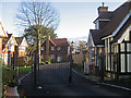
Housing diversity (Appleby Close)
A series of photos showing the diversity of housing in one gridsquare in outer suburbia. For others in series see http://www.geograph.org.uk/search.php?i=1905481. Any further information, such as building dates and what was on the sites before building, would be appreciated.
This is Appleby Close, the most recent development in the gridsquare (2006?). In fact I only discovered it in looking at an aerial photo on Google Maps – all other aerial photos and mapping sites show it as a spinney between Buckingham Close and St Johns Road. The gate gives the road an exclusivity that hardly seems necessary given the appearance of the surrounding roads.
Image: © Ian Capper
Taken: 21 Nov 2007
0.06 miles
3
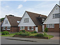
Housing diversity (St John's Road)
A series of photos showing the diversity of housing in one gridsquare in outer suburbia. For others in series see http://www.geograph.org.uk/search.php?i=1905481. Any further information, such as building dates and what was on the sites before building, would be appreciated.
This is St John's Road, one of the few roads in Petts Wood that had seen any development before the late 1920s. However, the subsequent filling in of gaps over the years (as well as demolition of older stock) has left the road with a large variety of housing types, such as this small group of high pitched houses.
Image: © Ian Capper
Taken: 5 Jun 2008
0.07 miles
4
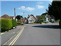
Approaching the boundary of Fairfield and Homesdale Roads
Image: © Basher Eyre
Taken: 4 Jun 2010
0.08 miles
5
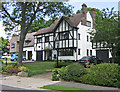
The Covert, Petts Wood
This 1930s road was one of the few in Petts Wood not developed on land originally purchased by Basil Scruby, the man behind the development of Petts Wood as a "garden suburb", having instead been built on land sold direct to the builders by the architect George St Pierre Harris, in whose family's land it had been held since the 1840s. Nevertheless it very much fits in with Scruby's ideal. Most of the houses were built in a "Tudor" style by Noel Rees, who was also responsible for part of Willett Way (see Image) and for The Chenies (see Image).
Image: © Ian Capper
Taken: 5 Jun 2008
0.08 miles
6
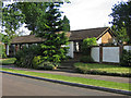
The Covert, Petts Wood
Most of The Covert was developed by the builder Noel Rees in the 1930s (see Image). However, a small section at the southern end was left undeveloped until the 1960s/1970s, when a couple of long single storey houses were built on the site, of which this is one.
Image: © Ian Capper
Taken: 5 Jun 2008
0.09 miles
7
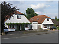
Housing diversity (St John's Road)
A series of photos showing the diversity of housing in one gridsquare in outer suburbia. For others in series see http://www.geograph.org.uk/search.php?i=1905481. Any further information, such as building dates and what was on the sites before building, would be appreciated.
This is St John's Road, one of the few roads in Petts Wood that had seen any development before the late 1920s. However, the subsequent filling in of gaps over the years (as well as demolition of older stock) has left the road with a large variety of housing types, such as these chalet type houses.
Image: © Ian Capper
Taken: 5 Jun 2008
0.09 miles
8
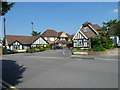
Looking from Fairfield Road over to Appleby Close
Image: © Basher Eyre
Taken: 4 Jun 2010
0.09 miles
9
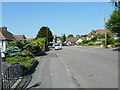
Looking from Homesdale Road along to Appleby Close
Image: © Basher Eyre
Taken: 4 Jun 2010
0.09 miles