The Covert, Petts Wood
Introduction
The photograph on this page of The Covert, Petts Wood by Ian Capper as part of the Geograph project.
The Geograph project started in 2005 with the aim of publishing, organising and preserving representative images for every square kilometre of Great Britain, Ireland and the Isle of Man.

There are currently over 7.5m images from over 14,400 individuals and you can help contribute to the project by visiting https://www.geograph.org.uk
The Covert, Petts Wood
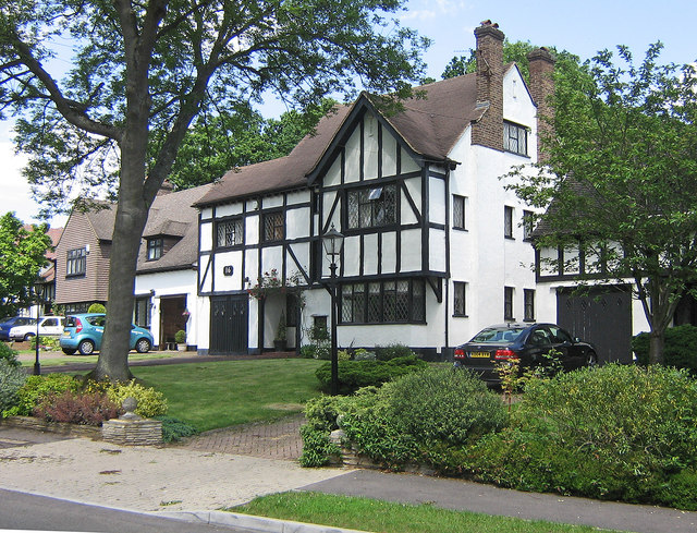
Image: © Ian Capper Taken: 5 Jun 2008
This 1930s road was one of the few in Petts Wood not developed on land originally purchased by Basil Scruby, the man behind the development of Petts Wood as a "garden suburb", having instead been built on land sold direct to the builders by the architect George St Pierre Harris, in whose family's land it had been held since the 1840s. Nevertheless it very much fits in with Scruby's ideal. Most of the houses were built in a "Tudor" style by Noel Rees, who was also responsible for part of Willett Way (see Image) and for The Chenies (see Image).
Images are licensed for reuse under creativecommons.org/licenses/by-sa/2.0
Image Location
Latitude
51.383802
Longitude
0.087384