1
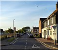
Stepping Stones Children & Family Centre
This building was originally St Peter's Church built in 1938 and closed in 2008. St Peter's started out as a combined school & mission church in 1880.
Image: © Josie Campbell
Taken: 2 Aug 2011
0.03 miles
2
Empty Factory
On the corner of Fishersgate Terrace, the A259, and Gardner Road. In the foreground is a stile over the crash barrier that allows access to the northern bank of The Canal.
Image: © Simon Carey
Taken: 4 Apr 2008
0.03 miles
3
Fishersgate Terrace
Looking to west to Shoreham power station
Image: © Richard Cooke
Taken: 5 Jun 2018
0.04 miles
4
Former Sea Cliffs
A reminder that once this area was just beach before the growth of the spit that diverted the mouth of the Adur eastwards. This part is between a small oil depot and Fishersgate. Out of view above the A259.
Image: © Simon Carey
Taken: 4 Apr 2008
0.05 miles
5
Playing fields at Portslade-by-Sea, Brighton and Hove
These fields are seen from Fishersgate Terrace (A259); West Road is on the right.
Image: © Roger D Kidd
Taken: 1 Jan 2013
0.06 miles
6
Shoreham Oil Terminal
Oil terminal on Shoreham Harbour, seen from Fishersgate Terrace. The ship in the background is the City of Chichester, a hopper dredger built in 1997.
Image: © Ian Capper
Taken: 21 Jan 2022
0.07 miles
7
West Road, Fishersgate
Developed during the mid 19th century as Shoreham Harbour grew and associated industries sprang up on the north bank. The Albion Inn is on the right and was named after an old oyster shop that had been built from the wrecked hulk of a ship called the Albion. A small recreation ground is on the left.
Image: © Simon Carey
Taken: 2 Dec 2010
0.08 miles
8
West Road, Fishersgate
Linking Fishersgate Terrace, the A259, to Gardner Road and originally built in the 1860s. The original terraced housing on the eastern site has long been removed with just the Albion Inn surviving.
Image: © Simon Carey
Taken: 17 May 2020
0.08 miles
9
Turning Basin
The section of The Canal that allows for ships to turn round before negotiating the lock to exit Shoreham Harbour. Texaco Wharf is in the foreground.
Image: © Simon Carey
Taken: 2 Dec 2010
0.08 miles
10
Texaco Wharf, Fishersgate, Sussex
Storage facility, beside The Canal, on the edge of Shoreham Harbour.
Image: © Peter Trimming
Taken: 17 Apr 2010
0.08 miles


