
IMAGES TAKEN NEAR TO
Old Shoreham Road, HOVE, BN3 7HA
Introduction
This page details the photographs taken nearby to Old Shoreham Road, BN3 7HA by members of the Geograph project.
The Geograph project started in 2005 with the aim of publishing, organising and preserving representative images for every square kilometre of Great Britain, Ireland and the Isle of Man.

There are currently over 7.5m images from over14,400 individuals and you can help contribute to the project by visiting https://www.geograph.org.uk
Image Map
Images are licensed for reuse under creativecommons.org/licenses/by-sa/2.0
Notes
- Clicking on the map will re-center to the selected point.
- The higher the marker number, the further away the image location is from the centre of the postcode.
Image Listing (47 Images Found)
Images are licensed for reuse under creativecommons.org/licenses/by-sa/2.0
Image
Details
Distance
1
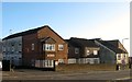
Stapley Court, Stapley Road, Knoll Estate, Hove
The block of flats are located on the eastern side of the road adjacent to the junction Old Shoreham Road, the A270. Originally the site of numbers 1-9 Stapley Road which appear to have been demolished along with houses on Old Shoreham Road when the road was widenedned in the mid 1970s. Flats look like they were built in the 1980s.
The Knoll Estate is located in the former northern portion of the parish of Aldrington which was once three open fields called The Knowle East, The Knowle West and The Knowle North according to its 1840 tithe map. The area was developed by Hove council from 1926 and mostly completed by 1939, the remaining undeveloped part at the northern end of Stapley Road was finished in the late 1940s.
Image: © Simon Carey
Taken: 22 Dec 2016
0.04 miles
2
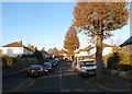
Florence Avenue, Hove
A residential road that links Hallyburton Road to Olive Road. Part of the Hallyburton estate which was developed in 1925 between the railway and Old Shoreham Road on a former field called Barn Field, according to Aldrington's 1841 tithe map, with the roads named after a local landowner and both his and the builder's daughters.
Image: © Simon Carey
Taken: 3 Dec 2016
0.05 miles
3
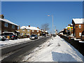
Stapley Road
Residential road that links Old Shoreham Road, the A270, with Hangleton Road, the A2038.
Image: © Simon Carey
Taken: 7 Jan 2010
0.06 miles
4
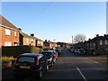
Bellingham Crescent, Knoll Estate, Hove
A resindential road that originally linked Stapley Road to Old Shoreham Road, the former A27, though the latter was blocked when the road was widened in the 1970s. The road was developed in the 1920s.
The Knoll Estate is located in the former northern portion of the parish of Aldrington which was once three open fields called The Knowle East, The Knowle West and The Knowle North according to its 1840 tithe map. The area was developed by Hove council from 1926 and mostly completed by 1939, the remaining undeveloped part at the northern end of Stapley Road was finished in the late 1940s.
Image: © Simon Carey
Taken: 22 Dec 2016
0.07 miles
5
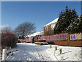
Knoll Business Centre
The building was originally Knoll School for Boys which opened in 1931 and closed in 1979 when a series of mergers between four single sex schools and one secondary modern produced two current secondary schools and rendered this building superfluous. Now a number of small business units.
Image: © Simon Carey
Taken: 7 Jan 2010
0.07 miles
6
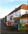
368-374, Old Shoreham Road, Hove
Numbers 368-370 are private houses though the latter looks like it may have been used as a commercial premises before. Number 372 is a Chinese takeaway and 374 a general store which for many years was a local post office. the houses were built in the 1920s.
Image: © Simon Carey
Taken: 22 Dec 2016
0.07 miles
7
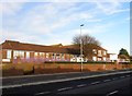
Knoll Business Centre, Old Shoreham Road, Hove
Built in 1931 as the Knoll School, educating both senior girls and boys, and included an infants block on the northern side. The school was built as a large rectangle with a line of offices dividing the building into two quadrangles, the western side for boys and the eastern one for girls. The growth in population due to the construction of Hangleton estate after the war meant space became a premium with the infants moved to a new site in Stapley Road in 1956, see Image, and the girls to a new campus in 1967 that later became Hove Park School. A large reorganisation of educational establishments in 1979 resulted in Knoll being merged with the mixed Nevill County Secondary and Hove Grammar School for Boys to become Blatchington Mill School. With the other two schools located on adjacent sites, Knoll became superfluous to needs and was sold off. In 1980 it reopened as a business centre, which it remains to this day.
The Knoll Estate is located in the former northern portion of the parish of Aldrington which was once three open fields called The Knowle East, The Knowle West and The Knowle North according to its 1840 tithe map. The area was developed by Hove council from 1926 and mostly completed by 1939, the remaining undeveloped part at the northern end of Stapley Road was finished in the late 1940s.
Image: © Simon Carey
Taken: 22 Dec 2016
0.07 miles
8
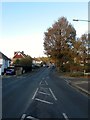
Olive Road, Hove
A road that links Old Shoreham Road, once the A27, to Portland Road, which was originally a farm track belonging to Aldrington Farm which was located south of the railway. Built up in 1925 as part of the Hallyburton estate whose roads were named after both the landowner and his and the builder's daughters.
Image: © Simon Carey
Taken: 3 Dec 2016
0.08 miles
9
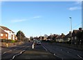
Old Shoreham Road, Hove
The former A27 until the completion of the Brighton Bypass in 1991 it is now the A270. Between Hove Cemetery in the east and the junctions with Boundary Road/Carlton Terrace and Hangleton Road in the west the road provides the dividing line between the Knoll Estate to the north and Hallyburton Estate to the south, both developed from the 1920s onwards having once been part of the parish of Aldrington. The road was made a dual carriageway in the mid 1970s necessitating demolition of houses on the northern side of the road and curtailment of gardens on the southern side.
Image: © Simon Carey
Taken: 22 Dec 2016
0.08 miles
10
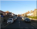
Margery Road, Hove
A residential road that originally ran from Hallyburton Road to Old Shoreham Road, then the A27. The northern junction with the latter was closed in the 1970s when the road was widened. Part of the Hallyburton estate which was developed in 1925 between the railway and Old Shoreham Road on a former field called Barn Field, according to Aldrington's 1841 tithe map, with the roads named after a local landowner and both his and the builder's daughters.
Image: © Simon Carey
Taken: 3 Dec 2016
0.09 miles