1
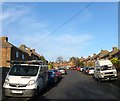
Wilfrid Road, Knoll Estate, Hove
A residential road linking Bellingham Crescent to Martin Road that was built in the late 1920s.
The Knoll Estate is located in the former northern portion of the parish of Aldrington which was once three open fields called The Knowle East, The Knowle West and The Knowle North according to its 1840 tithe map. The area was developed by Hove council from 1926 and mostly completed by 1939, the remaining undeveloped part at the northern end of Stapley Road was finished in the late 1940s.
Image: © Simon Carey
Taken: 22 Dec 2016
0.06 miles
2
Stapley Road
Residential road that links Old Shoreham Road, the A270, with Hangleton Road, the A2038.
Image: © Simon Carey
Taken: 7 Jan 2010
0.08 miles
3
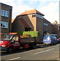
Bellingham Crescent, Knoll Estate, Hove
A resindential road that originally linked Stapley Road to Old Shoreham Road, the former A27, though the latter was blocked when the road was widened in the 1970s. The road was developed in the 1920s.
The Knoll Estate is located in the former northern portion of the parish of Aldrington which was once three open fields called The Knowle East, The Knowle West and The Knowle North according to its 1840 tithe map. The area was developed by Hove council from 1926 and mostly completed by 1939, the remaining undeveloped part at the northern end of Stapley Road was finished in the late 1940s.
Image: © Simon Carey
Taken: 22 Dec 2016
0.08 miles
4
Stapley Court, Stapley Road, Knoll Estate, Hove
The block of flats are located on the eastern side of the road adjacent to the junction Old Shoreham Road, the A270. Originally the site of numbers 1-9 Stapley Road which appear to have been demolished along with houses on Old Shoreham Road when the road was widenedned in the mid 1970s. Flats look like they were built in the 1980s.
The Knoll Estate is located in the former northern portion of the parish of Aldrington which was once three open fields called The Knowle East, The Knowle West and The Knowle North according to its 1840 tithe map. The area was developed by Hove council from 1926 and mostly completed by 1939, the remaining undeveloped part at the northern end of Stapley Road was finished in the late 1940s.
Image: © Simon Carey
Taken: 22 Dec 2016
0.10 miles
5
Knoll Recreation Ground, Hove
Built in the 1950s on Hudson's Tip, a former rubbish dump. Access is via footpath from Stapley Road and Rowan Avenue to the north and another that follows the former trackbed of the Dyke Railway from Hove Cemetery to the south. The park includes two junior football pitches, a green belonging to Hangleton Bowls Club immediately beyond the pavilion in view, an enclosed basketball court and a children's playground. The houses on the right face onto Rowan Avenue and were constructed in the 1930s.
Image: © Simon Carey
Taken: 5 Jan 2017
0.10 miles
6
Stapley Road, Knoll Estate, Hove
A residential road that links Old Shoreham Road, the A270, to Hangleton Road, the A2038. The road was developed as far as Martin Road in the 1920s with the remaining section north to Hangleton Road completed in the late 1940s.
The Knoll Estate is located in the former northern portion of the parish of Aldrington which was once three open fields called The Knowle East, The Knowle West and The Knowle North according to its 1840 tithe map. The area was developed by Hove council from 1926 and mostly completed by 1939, the remaining undeveloped part at the northern end of Stapley Road was finished in the late 1940s.
Image: © Simon Carey
Taken: 22 Dec 2016
0.10 miles
7
Old Shoreham Road, Hove
The former A27 until the completion of the Brighton Bypass in 1991 it is now the A270. Between Hove Cemetery in the east and the junctions with Boundary Road/Carlton Terrace and Hangleton Road in the west the road provides the dividing line between the Knoll Estate to the north and Hallyburton Estate to the south, both developed from the 1920s onwards having once been part of the parish of Aldrington. The road was made a dual carriageway in the mid 1970s necessitating demolition of houses on the northern side of the road and curtailment of gardens on the southern side.
Image: © Simon Carey
Taken: 22 Dec 2016
0.11 miles
8
Path to Knoll Recreation Ground
Route of the old railway line to Devils Dyke curving behind houses in Rowan Avenue.
Image: © Peter Holmes
Taken: 17 Mar 2012
0.12 miles
9
Footpath, Knoll Recreation Ground, Hove
Heading south east to join another that links Old Shoreham Road to Rowan Avenue that runs through the northern part of Hove Cemetery. The footpath here follows the trackbed of the former Dyke Railway that was opened in 1887 as an excursion route for tourists wishing to visit Devil's Dyke. The branch left the main west coast line at Aldrington (Originally known as Dyke Junction Halt) curving to the north, then west, then north again as it crossed open downland to a terminus situated next to Dyke Farm that was half a mile from the Dyke and required a walk up a steep gradient that was 200 foot below the summit. Two intermediate halts were added, the first in 1891 to serve Brighton & Hove Golf Club, called Golf Club Halt, and the other in 1933 to serve the newly built estates to the north which was called Rowan Halt. By then, however, the line was fast losing money to the motorbus trade which was able to drop visitors off right next to the Dyke and the line was closed on New Year's Eve 1938. The branch's alignment can be made out clearly north of the bypass but has largely been filled in to the south.
Image: © Simon Carey
Taken: 5 Jan 2017
0.12 miles
10
St Richard's Church, Egmont Road, Knoll Estate, Hove
Church and community centre built in the 1930s near the junction with Bellingham Crescent.
The Knoll Estate is located in the former northern portion of the parish of Aldrington which was once three open fields called The Knowle East, The Knowle West and The Knowle North according to its 1840 tithe map. The area was developed by Hove council from 1926 and mostly completed by 1939, the remaining undeveloped part at the northern end of Stapley Road was finished in the late 1940s.
Image: © Simon Carey
Taken: 22 Dec 2016
0.13 miles


