1
Portland Road, Hove
One of four east-west roads that run parallel to each other through the old parish of Aldrington, the others being Kingsway (A259), New Church Road (B2066) and Old Shoreham Road (A270). The road was laid out in the 1870s and developed gradually over the next forty or so years.
Image: © Simon Carey
Taken: 3 Dec 2016
0.07 miles
2
Mansfield Road, Aldrington, Hove
A residential road that links Portland Avenue to Portland Road. Originally part of a field called Great Golhards which was located within a detached portion of Portslade parish that was acquired by Aldrington in 1883 by which point part was used as a brick field. The road was laid out and developed in the early 1930s.
Image: © Simon Carey
Taken: 14 Dec 2016
0.11 miles
3
Woodhouse Road, Aldrington, Hove
A residential road that links Portland Avenue to Portland Road. Originally a field called Little Golhards that was located in a detached portion of Portslade parish that was acquired by Aldrington in 1883 by which point it was being used a brick field. Development occurred in the early 1930s with part of the road completed by the time of the 1932 OS map.
Image: © Simon Carey
Taken: 14 Dec 2016
0.11 miles
4
Portland Business Park, Portland Road, Hove
Originally an open field called South Gores, according to Aldrington's 1840 tithe map, that had become allotments by the time of the 1898 OS map and remained so until 1921 when the section adjacent to Olive road was acquired by the Brighton Equitable Co-Operative Society who initially built a bakery fronting onto Portland Road and later included buildings erected for their grocery, dairy and laundry departments. The site was vacated in the mid 1990s and the current trading estate built soon after.
See http://regencysociety-jamesgray.com/volume16/source/jg_16_054.html
Image: © Simon Carey
Taken: 3 Dec 2016
0.11 miles
5
Portland Avenue, Aldrington, Hove
A residential road that links New Church Road, the B2066, to Portland Road. Originally part of a field called Great Golhards that was located in a detached portion of Portlsade parish that was acquired by Aldrington in 1883 by which point part of was used as a brick field. The road was laid out and developed in the early 1930s.
Image: © Simon Carey
Taken: 14 Dec 2016
0.12 miles
6
Jesmond Road, Aldrington, Hove
A residential road that heads south from Portland Road joining Rothbury Road at the junction with Mornington Crescent. Originally an open space called Old field in Aldrington's 1840 tithe map both this road and neighbouring
Image were not developed until the 1930s.
Image: © Simon Carey
Taken: 3 Dec 2016
0.13 miles
7
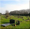
Hove Cemetery
The south western section which was not consecrated until 1912 despite being purchased at the same time as the rest which opened in 1882. For three decades it was used as a hay field. Beyond the trees to the south is the railway line.
Hove Cemetery consists of two parts, the original section south of Old Shoreham Road that was first consecrated in 1882 and a second to the north of the road that opened in 1923 as an extension
Image: © Simon Carey
Taken: 22 Jan 2017
0.14 miles
8
Bolsover Road, Aldrington, Hove
A residential road that links Portland Road to Kingsthorpe Road that had was developed before 1914.
Image: © Simon Carey
Taken: 14 Dec 2016
0.14 miles
9
Saxon Works, Olive Road, Hove
Former engineering works built in the 1950s that is now subdivided into a number of business units
Image: © Simon Carey
Taken: 3 Dec 2016
0.15 miles
10
Main Avenue, Hove Cemetery
Providing access from the far eastern to far western sides through the arch of the distant
Image This part is in the western section of the cemetery which was not consecrated until 1912 despite being purchased at the same time as the rest which opened in 1882.
Hove Cemetery consists of two parts, the original section south of Old Shoreham Road that was first consecrated in 1882 and a second to the north of the road that opened in 1923 as an extension
Image: © Simon Carey
Taken: 22 Jan 2017
0.16 miles


