IMAGES TAKEN NEAR TO
Davigdor Road, HOVE, BN3 1TT
Introduction
This page details the photographs taken nearby to Davigdor Road, BN3 1TT by members of the Geograph project.
The Geograph project started in 2005 with the aim of publishing, organising and preserving representative images for every square kilometre of Great Britain, Ireland and the Isle of Man.

There are currently over 7.5m images from over14,400 individuals and you can help contribute to the project by visiting https://www.geograph.org.uk
Image Map
Images are licensed for reuse under creativecommons.org/licenses/by-sa/2.0
Notes
- Clicking on the map will re-center to the selected point.
- The higher the marker number, the further away the image location is from the centre of the postcode.
Image Listing (261 Images Found)
Images are licensed for reuse under creativecommons.org/licenses/by-sa/2.0
Image
Details
Distance
1
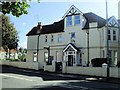
Gower Software Ltd, Hove
In Davigdor Road near to Seven Dials
Image: © Paul Gillett
Taken: 4 Oct 2012
0.01 miles
2
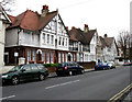
Osmond Gardens
The road actually has two names here, a reminder of the former borough boundaries that ran down it. The houses in view are Osmond Gardens whilst houses on the right out of shot are in Osmond Road.
Image: © Simon Carey
Taken: 15 Feb 2009
0.02 miles
6
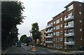
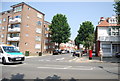
Richmond Court, Davigdor Road, Hove
Block of flats on the corner of Osmond Road that date from the 1960s.
Image: © Simon Carey
Taken: 4 Oct 2015
0.04 miles
7
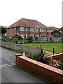
Davigdor Mansions
Built in 2006 in the grounds of the former Windlesham Bowling Club whose main building has now also been converted into flats. The club moved there in 1927 before moving out in 2004 merging with another club before folding. The flats have been built on the site of the former bowling green.
Image: © Simon Carey
Taken: 15 Feb 2009
0.04 miles
9
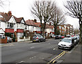
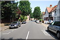
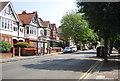
Davigdor Road
Part of the B2120 that runs from Seven Dials to Hove station. Davigdor Road is named after Osmond Elim D'avigdor Goldsmid a grandson of original landowner Isaac Goldsmid. The road has developed piecemeal with some of the original semi-detached houses being replaced by blocks of flats in the 1960s.
Image: © Simon Carey
Taken: 15 Feb 2009
0.05 miles
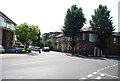
10
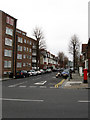
Osmond Road
Looking north from Davigdor Road, the road initially starts as a continuation of Windlesham Avenue before crossing the B2120 and heading towards its final destination, Addison Road.
Image: © Simon Carey
Taken: 15 Feb 2009
0.06 miles