1
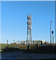
Farmland North of Saltdean
Viewed from the Eastern end of Homebush Avenue, an unmade road at the north of the estate, the telecommunication mast at the top of Longridge Avenue can be seen in the centre of the photo.
Image: © Paul Gillett
Taken: 25 Dec 2011
0.05 miles
2
Homebush Avenue, Saltdean
An unmade, dead end road that heads eastwards off the top of Longridge Avenue. The original plans envisaged heading eastwards to join Bannings Vale but this was never carried out probably due to a mixture of low take up of plots and an agreement to limit building beyond the 300 ft contour line.
Image: © Simon Carey
Taken: 27 Oct 2012
0.05 miles
3
Telecommunication Mast, Saltdean
At the northern end of Longridge Avenue
Image: © Paul Gillett
Taken: 26 Dec 2013
0.06 miles
4
Hartfield Road, Saltdean
Small link road that runs between Rodmell Avenue and Cissbury Crescent that wasn't part of the original plans but seems to have been added sometime in the late 1930s or 40s. The land drops down here into what was once Bannings Bottom with Telscombe Tye the large green swathe of land beyond.
Image: © Simon Carey
Taken: 27 Oct 2012
0.07 miles
5
Longridge Avenue, Saltdean
Longridge Avenue is a residential road in Saltdean, on the Sussex coast near Brighton. The road runs along the boundary between Brighton & Hove unitary authority (on the right) and the county of East Sussex (on the left).
This image was taken from the end of the road, looking southwards to the sea.
Image: © Malc McDonald
Taken: 24 Jul 2022
0.07 miles
6
Longridge Avenue, Saltdean
Longridge Avenue is a residential road in Saltdean, on the Sussex coast near Brighton.
The road runs along the boundary between Brighton & Hove unitary authority (on the left) and the county of East Sussex (on the right)/
Image: © Malc McDonald
Taken: 24 Jul 2022
0.07 miles
7
Bevendean Avenue - snowscene
Image: © Paul Gillett
Taken: 19 Dec 2010
0.07 miles
8
Rodmell Avenue, Saltdean
The road runs from Shepham Avenue in the west to Bannings Vale in the east and was marked out in the 1920s though development was slow and was not completed until the 1960s. Viewed from the junction with Hartfield Road.
Image: © Simon Carey
Taken: 27 Oct 2012
0.07 miles
9
Bevendean Avenue
The Avenue is one of the roads through Saltdean crossing the boundary between Brighton & Hove City Council and East Sussex Council at the Junction with Longridge Avenue. The Eastern end of the avenue is at the edge of Telscombe Tye
Image: © Paul Gillett
Taken: 30 May 2009
0.08 miles
10
Mast at Saltdean
This mast at the very top of Longridge Avenue in Saltdean is a valuable pointer to where you are. It is on the very edge of the South Downs National Park and the path ahead leads up into quiet downland, with fine views back to the coast.
Image: © Marathon
Taken: 5 Jun 2021
0.08 miles


