IMAGES TAKEN NEAR TO
Fox Lea, WORTHING, BN14 0XB

Introduction

This page details the photographs taken nearby to Fox Lea, BN14 0XB by members of the Geograph project.

The Geograph project started in 2005 with the aim of publishing, organising and preserving representative images for every square kilometre of Great Britain, Ireland and the Isle of Man.

There are currently over 7.5m images from over14,400 individuals and you can help contribute to the project by visiting https://www.geograph.org.uk

Image Map


Images are licensed for reuse under creativecommons.org/licenses/by-sa/2.0
Notes
  • Clicking on the map will re-center to the selected point.
  • The higher the marker number, the further away the image location is from the centre of the postcode.

Image Listing (80 Images Found)

Images are licensed for reuse under creativecommons.org/licenses/by-sa/2.0
  • ...
Image
Details
Distance
1
Fox Lea
A cul-de-sac heading east off Cross Lane that was developed in late 1990s on a field called Nepcutt Field according to Findon's 1839 tithe map.
Image: © Simon Carey Taken: 13 Jul 2013
0.03 miles
2
Steep Lane
This is looking east from Cross Lane in Findon. The Monarch's Way uses Steep Lane but the small waymark on the street name is not visible in the photograph.
Image: © Shazz Taken: 30 Jul 2010
0.06 miles
3
Steep Lane
Once part of an ancient east-west road that linked Steyning to Arundel it is now a quiet residential backwater linking High Street to Nepcote Green.
Image: © Simon Carey Taken: 8 Jun 2013
0.07 miles
4
Crossing lanes in Findon
The view is north along Cross Lane. Steep Lane which carries the Monarch's Way crosses here.
Image: © Shazz Taken: 30 Jul 2010
0.08 miles
5
Nepfield Close
A cul de sac located off Nepcote that is a fairly recent development built on the site of an old sawmill.
Image: © Simon Carey Taken: 26 Jul 2013
0.09 miles
6
Cottages, Nepcote
On the eastern side of the lane that shares its name with the hamlet.
Image: © Simon Carey Taken: 26 Jul 2013
0.09 miles
7
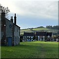
View west across Nepcote Green
The building on the left is the Wattle House. It dates from the end of the 1700s when it was used to store wattle hurdles for the sheep pens used during the annual sheep fair. [https://fancyfreewalks.org/W.Sussex/Findon.pdf]
Image: © Ian Hawfinch Taken: 11 Nov 2023
0.10 miles
8
Sycamore Court
A small private cul de sac off Steep Lane built on the site of a former nursing home.
Image: © Simon Carey Taken: 8 Jun 2013
0.10 miles
9
Findon Village
This pub is opposite the post office in the centre of Findon.
Image: © Pam Brophy Taken: 16 Apr 2005
0.10 miles
10
The Entrance to Findon Village
This road leads into the village of Findon as indicated by the sign at the roadside. This pub is on the corner of the road leading off the A27 and the A27, and the intersection is in the south western section of the grid square.
Image: © Pam Brophy Taken: 16 Apr 2005
0.10 miles
  • ...