IMAGES TAKEN NEAR TO
West Hill, WORTHING, BN13 3BZ
Introduction
This page details the photographs taken nearby to West Hill, BN13 3BZ by members of the Geograph project.
The Geograph project started in 2005 with the aim of publishing, organising and preserving representative images for every square kilometre of Great Britain, Ireland and the Isle of Man.

There are currently over 7.5m images from over14,400 individuals and you can help contribute to the project by visiting https://www.geograph.org.uk
Image Map (Loading...)


Getting Data...Please wait
Leaflet Map data © OpenStreetMap
Images are licensed for reuse under creativecommons.org/licenses/by-sa/2.0
Notes
- Clicking on the map will re-center to the selected point.
- The higher the marker number, the further away the image location is from the centre of the postcode.
Image Listing (52 Images Found)
Images are licensed for reuse under creativecommons.org/licenses/by-sa/2.0
Image
Details
Distance
1
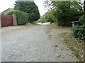
Northern end of West Hill High Salvington
Image: © Dave Spicer
Taken: 5 Oct 2011
0.02 miles
3
Heather Lane, Salvington
An unmade road
Image: © Josie Campbell
Taken: 28 Jul 2011
0.03 miles
4
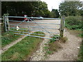
Gate by the car park on West Hill
One rusty chain 8 padlocks.
Image: © Dave Spicer
Taken: 5 Oct 2011
0.04 miles
5
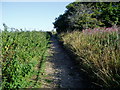
Bridleway at No Man's Land
Route to West Hill.
Image: © Peter Holmes
Taken: 25 Jul 2009
0.08 miles
7
Furzeholme, High Salvington
A cul de sac off Furze Road that was developed in the 1960s in the grounds of a former large house of the same name. The house still exists and is located around the corner.
Image: © Simon Carey
Taken: 30 Jun 2013
0.11 miles
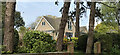
8
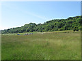
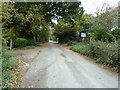
No Man's Land
The name of the field according to Findon's 1839 tithe map that is still marked on the map today. The name would often occur in areas where a number of undefined manorial or parish boundaries met. In this case the old parishes of Durrington, West Tarring and Findon met at this point. West Tarring was amalgamate with Durrington in 1902, Durrington was joined to Worthing borough in 1929 whilst the southern end of Findon followed in 1933. Interestingly there is another area called No Man's Land on the eastern boundary of the parish next to the point where it meets Steyning and Sompting.
Bost Hill car park is on the left which serves those wishing to use The Gallops open space which heads southwards between Salvington hill and the suburb of Findon Valley.
Image: © Simon Carey
Taken: 30 Jun 2013
0.12 miles
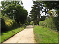
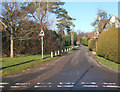
9
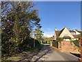
West Hill
The road West Hill leads to the hill of the same name.
Image: © Chris Thomas-Atkin
Taken: 26 Nov 2018
0.13 miles
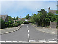
10
Honeysuckle Lane High Salvington
Honeysuckle Lane terminates for vehicles at the Honeysuckle Lane car park but continues as a restricted byway to meet the A280 near Tolmare Farm.
Image: © Dave Spicer
Taken: 5 Oct 2011
0.13 miles