
IMAGES TAKEN NEAR TO
Ashington Gardens, PEACEHAVEN, BN10 8UD
Introduction
This page details the photographs taken nearby to Ashington Gardens, BN10 8UD by members of the Geograph project.
The Geograph project started in 2005 with the aim of publishing, organising and preserving representative images for every square kilometre of Great Britain, Ireland and the Isle of Man.

There are currently over 7.5m images from over14,400 individuals and you can help contribute to the project by visiting https://www.geograph.org.uk
Image Map
Images are licensed for reuse under creativecommons.org/licenses/by-sa/2.0
Notes
- Clicking on the map will re-center to the selected point.
- The higher the marker number, the further away the image location is from the centre of the postcode.
Image Listing (49 Images Found)
Images are licensed for reuse under creativecommons.org/licenses/by-sa/2.0
Image
Details
Distance
1
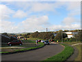
Ashington Gardens
The road was initially built as an east-west track straddling Downland Avenue with the eastern side a dead end. This loop was added during the 1960s. To the right is the Tudor Rose Caravan Park.
Image: © Simon Carey
Taken: 6 Jul 2012
0.02 miles
2
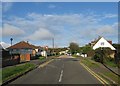
Roundhay Avenue
Part of the original 1920s layout the road runs from a right angled bend with Cissbury Avenue in the west, crosses Downland Avenue then becomes a cul de sac beyond.
Image: © Simon Carey
Taken: 6 Jul 2012
0.04 miles
3
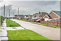
Ashington Gardens
Road at the eastern end of Peacehaven, marked without any houses on the 1928 25 inch map, with subsequent maps showing sporadic building, typical of the random development of Peacehaven.
Image: © Ian Capper
Taken: 21 May 2024
0.04 miles
4
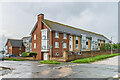
Downlands Court
Retirement flats between Roundhay Avenue, Downland Avenue and Cissbury Avenue, built in 2013.
Image: © Ian Capper
Taken: 21 May 2024
0.08 miles
5
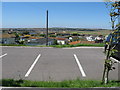
Tudor Rose residential park
Overlooking Peacehaven.
Image: © Dave Spicer
Taken: 22 Jul 2012
0.09 miles
6
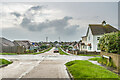
Ashington Gardens
Road at the eastern end of Peacehaven, marked without any houses on the 1928 25 inch map, with subsequent maps showing sporadic building, typical of the random development of Peacehaven.
Image: © Ian Capper
Taken: 21 May 2024
0.09 miles
7
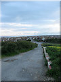
The Highway
Looking down towards its junction with South Coast Road, the A259, at the eastern end of Peacehaven. Now a restricted byway it was the original road to Newhaven across what was then open downland. The new route branching off to the right was added in the early 19th century when the road was turnpiked and lessened the gradient when negotiating Rushy Hill. The road is still used as an access route for the houses on Peacehaven Heights.
Image: © Simon Carey
Taken: 6 Jul 2012
0.10 miles
8
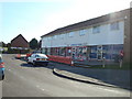
Ashington Gardens, Peacehaven, East Sussex
Image: © Stacey Harris
Taken: 2 Mar 2009
0.10 miles
9
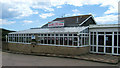
The Paradiso Coffee House, Peacehaven
This is shown on OS maps as a motel but this closed many years ago - the building was latterly used as a Coffee House but has closed and is awaiting redevelopment. Although the building fronts the busy A259 the rear has views over the English Channel.
Image: © Kevin Gordon
Taken: 20 Jul 2008
0.11 miles
10
Downland Avenue, Peacehaven, East Sussex
Image: © Stacey Harris
Taken: 2 Mar 2009
0.11 miles