
IMAGES TAKEN NEAR TO
Southview Road, PEACEHAVEN, BN10 8DR
Introduction
This page details the photographs taken nearby to Southview Road, BN10 8DR by members of the Geograph project.
The Geograph project started in 2005 with the aim of publishing, organising and preserving representative images for every square kilometre of Great Britain, Ireland and the Isle of Man.

There are currently over 7.5m images from over14,400 individuals and you can help contribute to the project by visiting https://www.geograph.org.uk
Image Map
Images are licensed for reuse under creativecommons.org/licenses/by-sa/2.0
Notes
- Clicking on the map will re-center to the selected point.
- The higher the marker number, the further away the image location is from the centre of the postcode.
Image Listing (31 Images Found)
Images are licensed for reuse under creativecommons.org/licenses/by-sa/2.0
Image
Details
Distance
1
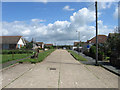
Horsham Avenue North
One of the original avenues laid out in 1920 when the town of Peacehaven was developed. The highway originally ran from Firle Road south to the A259 then beyond to the cliff tops. However, the section between Southview Road and Arundel Road was never built upon and had been truncated by the mid 1950s and the land between later used to build the Meridian Centre. For a while an attached garden centre used this route as an access road but has now been closed leaving just the fading lettering on the ground as a reminder.
Image: © Simon Carey
Taken: 9 Jun 2012
0.05 miles
2
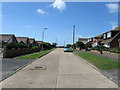
Edith Avenue North
One of the original avenues laid out in 1920 when the town of Peacehaven was developed. The highway originally ran from Firle Road south to the A259 then beyond to the cliff tops. However, the section between Southview Road and Arundel Road was never built upon and by the 1960s was little more than a dirt track which eventually disappeared when first, Image was developed, and then the Meridian Centre was added in the late 1970s requiring the local council to add the 'North' suffix to avoid people getting lost.
Image: © Simon Carey
Taken: 9 Jun 2012
0.07 miles
3
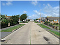
Southview Road
This east-west road runs between Cavell Avenue to the west and the open fields to the east. The crossroads with Image is just ahead.
Image: © Simon Carey
Taken: 9 Jun 2012
0.10 miles
4
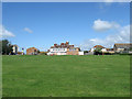
The Joff Playing Fields
Squeezed between the meridian Centre out of shot to the left and a residential area to the right. The playing field was once much more extensive but was lost to the development of the former during the late 1970s. The building beyond is Image the local youth centre whilst beyond is Image and to the left the new medical centre.
Image: © Simon Carey
Taken: 9 Jun 2012
0.10 miles
5
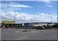
Peacehaven Community School
The school opened in 2001 to serve the expanding town after decades of demands for local residences ending many years of local children travelling into nearby Newhaven for the education. This is the entrance located immediately to the east of the Meridian Centre.
Image: © Simon Carey
Taken: 9 Jun 2012
0.12 miles
7

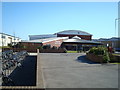
The Meridian Centre, Peacehaven
Indoor shopping centres in small towns have struggled badly in recent years but few are as forlorn as this where all the units are boarded up apart from one which houses Peacehaven Library. The centre was originally opened in 1979 but plans for its demolition were approved in 2023, the intention being to replace it with a Morrisons supermarket, ten smaller retail units and a new library space. As of May 2026, however, no work has begun.
Image: © Stephen McKay
Taken: 28 May 2026
0.14 miles
8
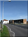
The Joff, Roderick Avenue
Peacehaven's youth club for nearly forty years built on the site of a former agricultural cottage known as Upper Hoddon. In my early teenage years around the late 1970s it was officially known as the youth club but nicknamed The Joff by those who used it, the nickname eventually becoming the official name still used thirty years on. Located at the point where Sutton Avenue becomes Roderick Avenue at the junction with Balcombe Road. The white building beyond was once a DIY shop but is now a private residence.
Image: © Simon Carey
Taken: 15 Mar 2009
0.15 miles
9
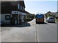
General store on Roderick Avenue Peacehaven
Image: © Dave Spicer
Taken: 23 Apr 2013
0.16 miles
10
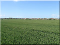
Farmland next to Peacehaven
Once part of the old sheep down of Piddinghoe much of which has disappeared since the 1920s under the town of Peacehaven. One wonders how long it will be before this last remaining part piece of farmland follows.
Image: © Simon Carey
Taken: 9 Jun 2012
0.17 miles