
IMAGES TAKEN NEAR TO
Phyllis Avenue, PEACEHAVEN, BN10 7RB
Introduction
This page details the photographs taken nearby to Phyllis Avenue, BN10 7RB by members of the Geograph project.
The Geograph project started in 2005 with the aim of publishing, organising and preserving representative images for every square kilometre of Great Britain, Ireland and the Isle of Man.

There are currently over 7.5m images from over14,400 individuals and you can help contribute to the project by visiting https://www.geograph.org.uk
Image Map
Images are licensed for reuse under creativecommons.org/licenses/by-sa/2.0
Notes
- Clicking on the map will re-center to the selected point.
- The higher the marker number, the further away the image location is from the centre of the postcode.
Image Listing (28 Images Found)
Images are licensed for reuse under creativecommons.org/licenses/by-sa/2.0
Image
Details
Distance
1
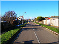
Balcombe Road, Peacehaven
Looking west from the junction with Hoddern Avenue near the school. Peacehaven was one of the reasons tough planning laws were introduced in 1947. Prior to 1919 this view would have been pasture farming on downland, then a mixture of World War One, cheap competition from abroad (particularly sheep farming) and rising death duties put many farmers out of business. The usual salvation was to sell to property developers, one being G.W.Neville who bought all the land now called Peacehaven and began selling plots particularly to returning soldiers. Neville made his money from building towns in America and this shows in the grid layout of Peacehaven. Originally called New Anzac on Sea the name was thought to be in bad taste and was renamed Peacehaven after a national competition.
Image: © Simon Carey
Taken: 25 Dec 2005
0.07 miles
2
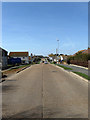
Arundel Road
Peacehaven has been designed quite literally as a grid with north-south avenues bisected by east-west roads, the major one being the South Coast Road, the A259. Running parallel to the north throughout the entire distance of Peacehaven is Arundel Road. This is the view from Hoddern Avenue. The road itself was unmade up to the late 1950s when the local council assumed responsibility for maintenance and made up all bar a few roads.
Image: © Simon Carey
Taken: 15 Mar 2009
0.10 miles
3
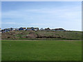
Howard Park
Viewed from Cairo Avenue South the park dates from the 1990s having previously been wasteland. Beyond is Malines Avenue South a private road that allows access down the cliff to the sea defences. The rough ground on the other side of that road is the site of the former Peacehaven Hotel a showpiece building constructed in 1922 with a variety of amenities including a landscaped Italian themed garden. All that remains today is the hotel's original garage which once stood opposite but for many years has housed small business units. The gardens had overgrown by the 1970s though it was still possible to uncover some of the remains amongst the undergrowth whilst the hotel was demolished in 1987 replaced by a carvery located on the main road out of shot to the left. For the last years of its life it was a pub, the first one I ever got served in!
Image: © Simon Carey
Taken: 15 Mar 2009
0.11 miles
4
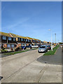
Hoddern Avenue
This part of the road would have been developed during the late 1960s on previously vacant plots, the uniformity suggesting that very little but fields existed here. Hoddern Avenue is named after the local farm and stretches from the cliff tops to Firle Road.
Image: © Simon Carey
Taken: 15 Mar 2009
0.13 miles
5
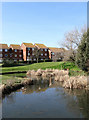
Lake Drive
The lake in the foreground is a pond formed from the excavation of clay for brickmaking and is marked on an 1879 map near to a cottage called Upper Hoddon. The development of Peacehaven from 1916 meant this section was gradually surrounded by plots of land though remained undeveloped into the 1980s before the eastern part of Balcombe Road was developed. The former overgrown pond, known to the local kids as 'The Swamp', was landscaped and a small housing estate developed around it. Newts still breed in the pond.
Image: © Simon Carey
Taken: 15 Mar 2009
0.15 miles
6
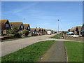
Rowe Avenue
The road was originally planned to begin at the cliff, cross the South Coast Road then head north to Firle Road. However, the failure to sell many plots meant the road was undeveloped north of Arundel Road until the 1960s when this northern section was built but not connected to Arundel Road, the likelihood decreasing further when Hoddern Juniour School occupied the site. Subsequently, Rowe Avenue is now a road in four distinct parts, beginning from the cliff top to South Coast Road, the A259; the section between the latter and Arundel Road which had its opening onto the main closed in 1961; a small unmade section north of Arundel Road; and this part between Balcombe and Firle Road. Giving visitors directions to a house on this section would near enough always result in them getting lost.
Image: © Simon Carey
Taken: 15 Mar 2009
0.15 miles
7
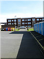
Balcombe Road Flats
Constructed around 1977-78 on previously waste ground. Looking from the garages towards the flats that line the east side of Rowe Avenue.
Image: © Simon Carey
Taken: 15 Mar 2009
0.15 miles
10
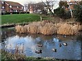
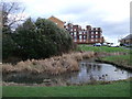
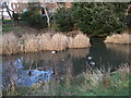
Lake Park Pond
Great Crested Newts can be seen in the picture
Image: © Paul Gillett
Taken: 27 Dec 2009
0.16 miles