
IMAGES TAKEN NEAR TO
South Coast Road, PEACEHAVEN, BN10 7EJ
Introduction
This page details the photographs taken nearby to South Coast Road, BN10 7EJ by members of the Geograph project.
The Geograph project started in 2005 with the aim of publishing, organising and preserving representative images for every square kilometre of Great Britain, Ireland and the Isle of Man.

There are currently over 7.5m images from over14,400 individuals and you can help contribute to the project by visiting https://www.geograph.org.uk
Image Map
Images are licensed for reuse under creativecommons.org/licenses/by-sa/2.0
Notes
- Clicking on the map will re-center to the selected point.
- The higher the marker number, the further away the image location is from the centre of the postcode.
Image Listing (80 Images Found)
Images are licensed for reuse under creativecommons.org/licenses/by-sa/2.0
Image
Details
Distance
1
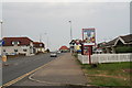
Main road through Peacehaven
Right is Malines Avenue South, which runs through Howard Park.
Image: © Chris
Taken: 11 Jun 2016
0.02 miles
2
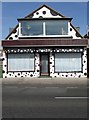
Eliska House, South Coast Road
Former shop once known as the Cairo Stores that has been converted into residence sometime during the 1990s I believe. The outside decor stands out here but would not look out of place in one of Brighton's trendier shopping streets.
Image: © Simon Carey
Taken: 15 Mar 2009
0.03 miles
3
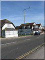
Former Shops, South Coast Road
Peacehaven's haphazard development extended to commercial and retail activities. Until the late 1970s there was no central business district as in the 1920s shops and businesses would just buy a plot and operate from that. These three are a case in point, located around the junction of Cairo Avenue, which was closed off to traffic in 1961, all originate from the late 1920s, all were originally shops but only the one at the far end is now used for commercial purposes being an Indian takeaway. The house on the left was certainly residential by the mid 1970s and was probably converted much early, whilst the one in the middle with the black spots was for a long time a small cornershop known as the Cairo Stores but that too has been converted into a residence sometime in the 1990s.
Image: © Simon Carey
Taken: 15 Mar 2009
0.03 miles
4
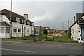
Cairo Avenue South, Peacehaven
See https://en.wikipedia.org/wiki/Peacehaven
Peacehaven is characterised by the grid system of its streets, and seemingly the concrete roadways, here visible beyond the line of posts. See Image for detail.
There also seems to be some artistic licence in paint schemes and building styles!
The town was originally formed for retiring WWI veterans in order for them to escape and recover from the effects of the war. The idyllic setting, sea air and simple lifestyle were thought to have aided good health. The land was also cheap and, as a result, working-class families from the city started to purchase plots and gradually build makeshift homes for weekends and holidays. This movement of frontier style buildings made with whatever materials were available at the time was termed as the Plotlands movement. Inhabitants felt a sense of freedom in living off what they needed and enjoying a simpler life away from the busy, polluted city. The Plotlands provided the working class an opportunity that might not have been available otherwise.
Image: © Chris
Taken: 11 Jun 2016
0.03 miles
5
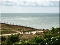
The coast and Mariners Avenue
Near Newhaven.
Image: © John Lucas
Taken: 15 Aug 2024
0.04 miles
6
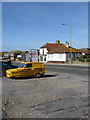
Junction of Phyllis Avenue and South Coast Road
The Robin Reliant advertises a business located in the garage that once belonged to the demolished Peacehaven Hotel. The two buildings opposite again highlight the lack of proper planning inherent in Peacehaven's development. The bungalow on the left was first occupied by Barclays Bank in 1923, the first bank in the town, before it moved to larger premises eastwards next to Roderick Avenue where it remains to this day. The house beyond was also built in the 1920s but has remained a shop throughout its life though it is currently empty.
Image: © Simon Carey
Taken: 15 Mar 2009
0.04 miles
9
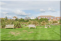
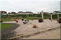
Howard Park
Clifftop open space in Peacehaven, with houses on South Coast Road in the background.
Image: © Ian Capper
Taken: 20 Sep 2022
0.06 miles
10
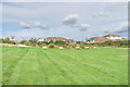
Howard Park
Clifftop open space in Peacehaven, with houses on South Coast Road in the background.
Image: © Ian Capper
Taken: 20 Sep 2022
0.06 miles