Former Shops, South Coast Road
Introduction
The photograph on this page of Former Shops, South Coast Road by Simon Carey as part of the Geograph project.
The Geograph project started in 2005 with the aim of publishing, organising and preserving representative images for every square kilometre of Great Britain, Ireland and the Isle of Man.

There are currently over 7.5m images from over 14,400 individuals and you can help contribute to the project by visiting https://www.geograph.org.uk
Former Shops, South Coast Road
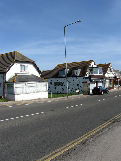
Image: © Simon Carey Taken: 15 Mar 2009
Peacehaven's haphazard development extended to commercial and retail activities. Until the late 1970s there was no central business district as in the 1920s shops and businesses would just buy a plot and operate from that. These three are a case in point, located around the junction of Cairo Avenue, which was closed off to traffic in 1961, all originate from the late 1920s, all were originally shops but only the one at the far end is now used for commercial purposes being an Indian takeaway. The house on the left was certainly residential by the mid 1970s and was probably converted much early, whilst the one in the middle with the black spots was for a long time a small cornershop known as the Cairo Stores but that too has been converted into a residence sometime in the 1990s.
Images are licensed for reuse under creativecommons.org/licenses/by-sa/2.0
Image Location
Latitude
50.793285
Longitude
-0.009601