Junction of Phyllis Avenue and South Coast Road
Introduction
The photograph on this page of Junction of Phyllis Avenue and South Coast Road by Simon Carey as part of the Geograph project.
The Geograph project started in 2005 with the aim of publishing, organising and preserving representative images for every square kilometre of Great Britain, Ireland and the Isle of Man.

There are currently over 7.5m images from over 14,400 individuals and you can help contribute to the project by visiting https://www.geograph.org.uk
Junction of Phyllis Avenue and South Coast Road
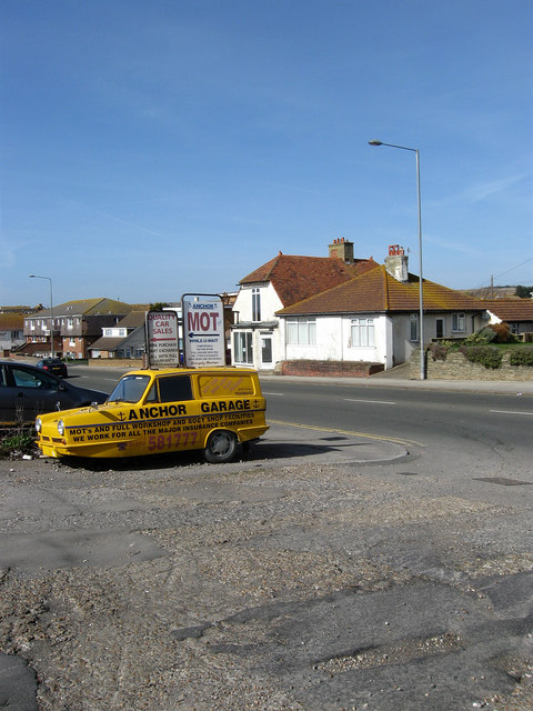
Image: © Simon Carey Taken: 15 Mar 2009
The Robin Reliant advertises a business located in the garage that once belonged to the demolished Peacehaven Hotel. The two buildings opposite again highlight the lack of proper planning inherent in Peacehaven's development. The bungalow on the left was first occupied by Barclays Bank in 1923, the first bank in the town, before it moved to larger premises eastwards next to Roderick Avenue where it remains to this day. The house beyond was also built in the 1920s but has remained a shop throughout its life though it is currently empty.
Images are licensed for reuse under creativecommons.org/licenses/by-sa/2.0
Image Location
Latitude
50.792813
Longitude
-0.008344