IMAGES TAKEN NEAR TO
Redbreast Road, BOURNEMOUTH, BH9 3AP

Introduction

This page details the photographs taken nearby to Redbreast Road, BH9 3AP by members of the Geograph project.

The Geograph project started in 2005 with the aim of publishing, organising and preserving representative images for every square kilometre of Great Britain, Ireland and the Isle of Man.

There are currently over 7.5m images from over14,400 individuals and you can help contribute to the project by visiting https://www.geograph.org.uk

Image Map


Images are licensed for reuse under creativecommons.org/licenses/by-sa/2.0
Notes
  • Clicking on the map will re-center to the selected point.
  • The higher the marker number, the further away the image location is from the centre of the postcode.

Image Listing (81 Images Found)

Images are licensed for reuse under creativecommons.org/licenses/by-sa/2.0
  • ...
Image
Details
Distance
1
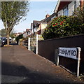
Moordown: Cobham Road
Cobham Road is a short side-road in the north of Moordown, characterised like the surrounding area by desirable detached houses. The sign is the standard Bournemouth nameplate from the 1980s, affixed with tubular steel which protrudes at each side. This is photo no.73 of a series of 453 in my coronavirus lockdown walking project: See https://www.geograph.org.uk/article/My-2020-Coronavirus-Lockdown-walking-project for the complete set of photos.
Image: © Chris Downer Taken: 12 Apr 2020
0.02 miles
2
Moordown: footpath M13 towards Redbreast Road
Looking across the same railings as in Image, but in the opposite direction. See: Image for a view towards us from the end of the path ahead; Image for a view along the path from the end behind us; and Image for a view along footpath M14, which heads left just here.
Image: © Chris Downer Taken: 10 Jul 2016
0.05 miles
3
Moordown: footpath M13 from Redbreast Road
Looking across the carriageway of Redbreast Road, along a driveway access which also forms a public footpath to Nursery Road. See Image for a picture as it approaches the far end.
Image: © Chris Downer Taken: 22 Jun 2016
0.05 miles
4
Moordown: footpath M13 approaches Nursery Road
Looking along this short public footpath between Redbreast and Nursery Roads as it reaches the latter. Just beyond the barriers, to the right, is another footpath, separately numbered M14, which cuts a little corner off if you wish to turn right (see Image). See Image for a view towards us from the end of the path ahead, andImage] for a view over these same railings but towards and behind us.
Image: © Chris Downer Taken: 22 Jun 2016
0.06 miles
5
Moordown: looking up footpath M14
This short public footpath essentially cuts the corner off from path M13, from which we look, for those wishing to turn right up Nursery Road. It is visible turning off to the right here: Image (we are standing just beyond the railings in that picture). See Image for a view down the path from the top end.
Image: © Chris Downer Taken: 10 Jul 2016
0.06 miles
6
Moordown: footpath M13 from Nursery Road
Looking along this public footpath linking two parallel roads, Nursery and Redbreast. See Image for the view towards us from the railings just visible, and Image for the onward view over the railings towards Redbreast Road.
Image: © Chris Downer Taken: 10 Jul 2016
0.07 miles
7
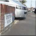
Moordown: Lystra Road
Looking along the pavement of this cul-de-sac of detached houses typical of the whole Moordown area. The sign is the standard Bournemouth nameplate from the 1980s, usually affixed with tubular steel which protrudes at each side, with a no-through-road sign incorporated into it. I expect this one would originally have been fixed in that way. This is photo no.251 of a series of 453 in my coronavirus lockdown walking project: See https://www.geograph.org.uk/article/My-2020-Coronavirus-Lockdown-walking-project for the complete set of photos.
Image: © Chris Downer Taken: 10 Apr 2020
0.07 miles
8
Moordown: public footpath M14
If you carry on walking down the pavement (to the right of the bushes), you will find a public footpath, M13, to your left. However, this short public footpath, M14, cuts the corner off slightly. See Image] for path M13 as M14 comes out on it (i.e. by the wheelie bin in the background).
Image: © Chris Downer Taken: 22 Jun 2016
0.07 miles
9
Moordown: former Congregational Church
This church stands at the top of Priory View Road (which descends to the left of the picture and from here does indeed offer fine views across to Christchurch). It has lain unused for several years.
Image: © Chris Downer Taken: 24 Feb 2008
0.09 miles
10
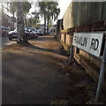
Moordown: Franklin Road
A short road of detached houses – just four or five on each side – in an area almost all made up of these decent, early 20th century houses. The sign is the standard Bournemouth nameplate from the 1980s, affixed with tubular steel which protrudes at each side. This is photo no.149 of a series of 453 in my coronavirus lockdown walking project: See https://www.geograph.org.uk/article/My-2020-Coronavirus-Lockdown-walking-project for the complete set of photos.
Image: © Chris Downer Taken: 12 Apr 2020
0.09 miles
  • ...