
IMAGES TAKEN NEAR TO
Bloomfield Place, BOURNEMOUTH, BH9 1UB
Introduction
This page details the photographs taken nearby to Bloomfield Place, BH9 1UB by members of the Geograph project.
The Geograph project started in 2005 with the aim of publishing, organising and preserving representative images for every square kilometre of Great Britain, Ireland and the Isle of Man.

There are currently over 7.5m images from over14,400 individuals and you can help contribute to the project by visiting https://www.geograph.org.uk
Image Map
Images are licensed for reuse under creativecommons.org/licenses/by-sa/2.0
Notes
- Clicking on the map will re-center to the selected point.
- The higher the marker number, the further away the image location is from the centre of the postcode.
Image Listing (98 Images Found)
Images are licensed for reuse under creativecommons.org/licenses/by-sa/2.0
Image
Details
Distance
1
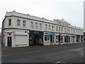
Moordown: Mayfield Park Buildings from the north
This attractive parade of shops, at 929-943 Wimborne Road, faced an uncertain future as, gradually, all but one of the shops ceased trading and were not replaced. However, it appears to be thriving now.
The southern end of the parade is in the next square south – see Image
Image: © Chris Downer
Taken: 24 Feb 2008
0.02 miles
2

Moordown: footpath M01 approaches Wimborne Road
Looking along the northwestern end of this 200m-long straight path, as it reaches the main Wimborne Road.
See Image for a picture looking back up towards us, and Image for the next picture of the path behind us.
Image: © Chris Downer
Taken: 22 Jun 2016
0.02 miles
3
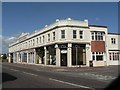
Moordown: Mayfield Park Buildings from the south
This attractive parade of shops, at 929-943 Wimborne Road, faced an uncertain future as, gradually, all but one of the shops ceased trading and were not replaced. However, it appears to be thriving now.
The northern end of the parade is in the next square north – see Image
Image: © Chris Downer
Taken: 22 Jun 2008
0.02 miles
4
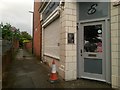
Moordown: footpath M01 to Mayfield Road
Looking alongside Image along this public footpath, which runs dead straight for just over 200m to meet Mayfield Road.
See Image for the next picture along the path.
Image: © Chris Downer
Taken: 22 Jun 2016
0.02 miles
5
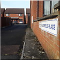
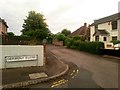
Moordown: Bloomfield Place
A mid-1990s infill development towards the western end of Bloomfield Avenue, whose sign, from a distance, resembles the standard borough nameplate of the time (see for example Image) – but in fact it isn't, so presumably it was erected by the developer rather than the council.
This is photo no.42 of a series of 453 in my coronavirus lockdown walking project:
See https://www.geograph.org.uk/article/My-2020-Coronavirus-Lockdown-walking-project for the complete set of photos.
Image: © Chris Downer
Taken: 17 Apr 2020
0.02 miles
6
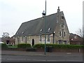
Moordown: the old school
This building was the village school of Moordown until it was replaced by purpose-built premises near the parish church in the early 20th century. Having spent most of the 20th century as a retail premises, it has now been converted to dwellings and, along with new houses in its grounds, is called Old St. John’s Mews.
Image: © Chris Downer
Taken: 24 Feb 2008
0.02 miles
7
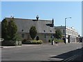
Moordown: Wimborne Road and the old school
Looking down Wimborne Road from the northern end of Moordown shops – prominent is Image and next to it is Image
Image: © Chris Downer
Taken: 22 Jun 2008
0.03 miles
8
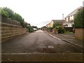
Moordown: Rose Gardens from its dead end
Looking along this residential street, this half of which also forms public footpath M02. To our immediate left and right runs another public path, number M01, between Wimborne and Mayfield Roads - see Image
See Image for a view towards us from the junction ahead.
Image: © Chris Downer
Taken: 22 Jun 2016
0.03 miles
9
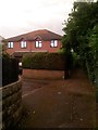
Moordown: footpath M01 meets Rose Gardens
Looking along this straight public footpath between Wimborne and Mayfield Roads. About a third of the way along, it meets the dead end of Rose Gardens, also a public right of way.
See Image for the next photo along the path ahead of us;
Image for the next photo behind; and
Image for a view along Rose Gardens from here.
Image: © Chris Downer
Taken: 22 Jun 2016
0.03 miles
10
Moordown: the end of Rose Gardens from Derwent Close
The opposing view to Image This segment of Rose Gardens forms a public footpath, numbered M02, linking up with footpath M01 at the dead end ahead (see Image]).
The public right of way actually starts from the Rosebud Avenue turning, the next one behind us - see Image
The cottage on the right is just in this gridsquare, while the actual dead end is in the next square east.
Image: © Chris Downer
Taken: 22 Jun 2016
0.03 miles