
IMAGES TAKEN NEAR TO
Ophir Gardens, BOURNEMOUTH, BH8 8LR
Introduction
This page details the photographs taken nearby to Ophir Gardens, BH8 8LR by members of the Geograph project.
The Geograph project started in 2005 with the aim of publishing, organising and preserving representative images for every square kilometre of Great Britain, Ireland and the Isle of Man.

There are currently over 7.5m images from over14,400 individuals and you can help contribute to the project by visiting https://www.geograph.org.uk
Image Map
Images are licensed for reuse under creativecommons.org/licenses/by-sa/2.0
Notes
- Clicking on the map will re-center to the selected point.
- The higher the marker number, the further away the image location is from the centre of the postcode.
Image Listing (243 Images Found)
Images are licensed for reuse under creativecommons.org/licenses/by-sa/2.0
Image
Details
Distance
1
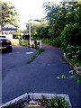
Springbourne: footpath C22 from Ophir Gardens
Looking southwest from the very corner of the dead end of Ophir Gardens (we can see a bit of the double yellow lines at the bottom of the picture).
Ophir Gardens was part of Ophir Road until it was severed to make way for the A338 Wessex Way to be built in the early 1970s - the Wessex Way is just to our right.
The public footpath leads to a footbridge (the spiral ramp can be seen in the background) and also leads to Portchester Place and Wellington Road via footpath C13 continuing straight on beyond the bridge.
See Image] for a picture looking in the same direction but closer to the bridge, and Image] for a view towards us from the footbridge ramp.
Image: © Chris Downer
Taken: 3 Jul 2016
0.02 miles
2
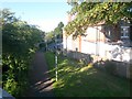
Springbourne: footpath C22 to Ophir Gardens
Looking down from the footbridge ramp along this short public footpath which comes out at the dead end of Ophir Gardens ahead. This is the opposing view to Image
See Image for a view along the path from the far end, and Image for a view along the footbridge, which is footpath C21.
Image: © Chris Downer
Taken: 3 Jul 2016
0.02 miles
4
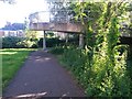
Springbourne: footpath C22 approaches the footbridge
Looking along this public footpath from Ophir Gardens as it arrives at the spiral ramp of the footbridge. The footbridge is a separate public footpath, number C21.
See:
Image for a view to this point from behind us;
Image for a view towards us from the ramp above; and
Image for a view of the junction of paths that we will reach by walking ahead.
Image: © Chris Downer
Taken: 3 Jul 2016
0.03 miles
5
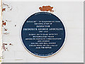
Bournemouth Blue Plaques: No. 27 - Inspector F G Abberline
The plaque is on the front of 195, Holdenhurst Road the retirement home in 1904 of Inspector Frederick George Abberline when it was known as "Estcourt". He was most well known, and indeed made famous by his work on the notorious "Jack the Ripper" murder case. He died at "Estcourt" aged 86 in 1929, and is buried in Bournemouth's Wimborne Road Cemetery where a black granite headstone was erected in 2007 on his previously unmarked grave.
Image
Image
Image: © Mike Searle
Taken: 8 Apr 2015
0.03 miles
6
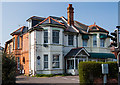
Bournemouth - 195, Holdenhurst Road
The retirement home in 1904 of the former "Jack the Ripper" case detective, Inspector Frederick George Abberline (1843 - 1929) when it was known as "Estcourt". He died here in 1929, and was buried in an unmarked grave in Bournemouth's Wimborne Road Cemetery. A campaign in recent times for the grave to be recognised culminated in 2007 by the provision of a suitably inscribed granite headstone, commemorating both Frederick and his wife Emma.
Image
Image: © Mike Searle
Taken: 8 Apr 2015
0.03 miles
7
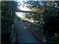
Springbourne: footpath C13 reaches the footbridge
Looking along the end of this public footpath, which has run alongside the main A338 Wessex Way and now reaches the footbridge which crosses it.
The path to the right, the bottommost part of the spiral ramp, leads to a separate public footpath, numbered C22, to Ophir Gardens, while the footbridge itself is footpath C21.
See:
Image for a view along the footbridge;
Image for a view of footpath C22; and
Image] for the next view along the path behind us.
Image: © Chris Downer
Taken: 3 Jul 2016
0.04 miles
8
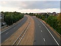
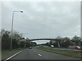
Springbourne: an empty outbound Wessex Way
Looking out of town on the main Wessex Way (A338), during extra time in the World Cup semi-final between England and Croatia. It is not true to say that there was nothing at all on the road, but it was unusually quiet and it took me less than 30 seconds to take a traffic-free snapshot in each direction.
See Image for the inbound view.
Image: © Chris Downer
Taken: 11 Jul 2018
0.04 miles
9
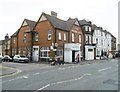
Springbourne, George Hall
Former temperance hall and hostel on Holdenhurst Road.
Image: © Mike Faherty
Taken: 21 May 2015
0.04 miles
10
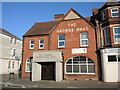
The former George Hotel and Hostel
This hall was originally known as the Massingberd Hotel. It then was taken over and reused the George Temperance Trust. Today it is home to a performing arts studio.
Image: © Neil Owen
Taken: 22 Jun 2022
0.04 miles