Springbourne: footpath C22 from Ophir Gardens
Introduction
The photograph on this page of Springbourne: footpath C22 from Ophir Gardens by Chris Downer as part of the Geograph project.
The Geograph project started in 2005 with the aim of publishing, organising and preserving representative images for every square kilometre of Great Britain, Ireland and the Isle of Man.

There are currently over 7.5m images from over 14,400 individuals and you can help contribute to the project by visiting https://www.geograph.org.uk
Springbourne: footpath C22 from Ophir Gardens
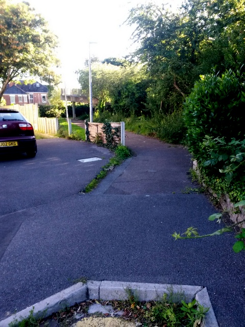
Image: © Chris Downer Taken: 3 Jul 2016
Looking southwest from the very corner of the dead end of Ophir Gardens (we can see a bit of the double yellow lines at the bottom of the picture). Ophir Gardens was part of Ophir Road until it was severed to make way for the A338 Wessex Way to be built in the early 1970s - the Wessex Way is just to our right. The public footpath leads to a footbridge (the spiral ramp can be seen in the background) and also leads to Portchester Place and Wellington Road via footpath C13 continuing straight on beyond the bridge. See Image] for a picture looking in the same direction but closer to the bridge, and Image] for a view towards us from the footbridge ramp.
Images are licensed for reuse under creativecommons.org/licenses/by-sa/2.0
Image Location
Latitude
50.729155
Longitude
-1.860389