
IMAGES TAKEN NEAR TO
Iford Lane, BOURNEMOUTH, BH6 5NF
Introduction
This page details the photographs taken nearby to Iford Lane, BH6 5NF by members of the Geograph project.
The Geograph project started in 2005 with the aim of publishing, organising and preserving representative images for every square kilometre of Great Britain, Ireland and the Isle of Man.

There are currently over 7.5m images from over14,400 individuals and you can help contribute to the project by visiting https://www.geograph.org.uk
Image Map
Images are licensed for reuse under creativecommons.org/licenses/by-sa/2.0
Notes
- Clicking on the map will re-center to the selected point.
- The higher the marker number, the further away the image location is from the centre of the postcode.
Image Listing (46 Images Found)
Images are licensed for reuse under creativecommons.org/licenses/by-sa/2.0
Image
Details
Distance
1
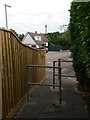
Tuckton: footpath I20 reaches Iford Close
A public right of way from Saxonbury Road, footpath I20, follows a rear access driveway and then this alley, arriving here at the dead end of Iford Close. Unusually the extent of the public right of way, as mapped, appears to comprise only the driveway and exclude the alley itself.
See Image for the view towards us from the middle of the road ahead, and Image for the next view on the path behind us, with links to further photos on the route.
Image: © Chris Downer
Taken: 24 Sep 2016
0.02 miles
2
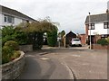
Tuckton: footpath I20 from Iford Close
A public right of way, footpath I20, leads from here the dead end of Iford Close, to Saxonbury Road, by way of this alley followed by a rear access driveway. Unusually the extent of the public right of way, as mapped, appears to comprise only the driveway and exclude the alley itself.
See Image for the next view along the path ahead, with links to further photos on the route.
Image: © Chris Downer
Taken: 24 Sep 2016
0.02 miles
3
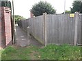
Tuckton: alleyway to Iford Close
A driveway behind us forms public footpath I20, which proceeds along this alley to reach the dead end of Iford Close - although unusually the extent of the public right of way, as mapped, appears to comprise only the driveway and exclude the alley itself.
See Image for the next view along the route behind us, and Image for the emergence ahead - each with links to further photos on the route.
Image: © Chris Downer
Taken: 24 Sep 2016
0.02 miles
4

Tuckton: footpath I20 in the direction of Iford Close
This driveway to rear garage accesses, which arrives here from our sharp right, opens out into a T-shape, and this arm forms the continuation of public footpath I20 to Iford Close. It heads along an alley by the lamppost ahead to reach the dead end of Iford Close, although unusually the extent of the public right of way, as mapped, appears to exclude the alley itself.
See Image for the view along the driveway to the right, and Image for the view along the alley ahead - each with links to further photos on the route.
Image: © Chris Downer
Taken: 24 Sep 2016
0.03 miles
5
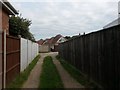
Tuckton: driveway forming footpath I20
This driveway, to rear garage accesses, also forms a public footpath to Iford Close from Saxonbury Road. It turns to the right ahead to reach the dead end of Iford Close.
See Image for the view up the drive from the end behind us, and Image for the view towards us from ahead, with links to further photos on the route.
Image: © Chris Downer
Taken: 24 Sep 2016
0.03 miles
6
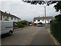
Tuckton: Iford Close
Iford Close is a small cul-de-sac of Iford Lane, and we look here towards its dead end. A footpath continues through to Saxonbury Road ahead - see Image
Image: © Chris Downer
Taken: 24 Sep 2016
0.03 miles
7
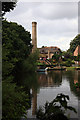
The old waterworks pumping station at Tuckton
The pumping station at the Old Water Works site at Tuckton dates from c.1875, and forms part of a group of buildings that was occupied from 1900-13 by Russian emigres, led by Count Vladimir Tchertkov. They established their Free Age Press on which many of Tolstoy's later works (banned in Russia) were first printed. The building has been much altered and extended over the years, finally being converted into a private dwelling in 1988. Grade II Listed.
Image
Image: © Mike Searle
Taken: 6 Jul 2008
0.03 miles
8
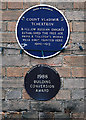
Bournemouth Blue Plaques No. 2 - Count Vladimir Tchertkov
A blue plaque is affixed to the end wall of the former pumping station at the Old Waterworks site at Tuckton to commemorate the establishment of a printing press here by a group of Russian emigrés led by Count Vladimir Tchertkov. On this site in 1900-13 the later works of Tolstoy were first printed. The building was converted into a private dwelling in 1988, and the smaller plaque records the conversion award from Bournemouth Borough Council in that year.
Image
Image
Image: © Mike Searle
Taken: 6 Jul 2008
0.03 miles
9
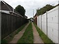
Tuckton: footpath I20 heads for Saxonbury Road
Looking along a garage driveway which forms public footpath I20 from Iford Close to Saxonbury Road, which latter street we see in the distance.
See Image for the view towards us from ahead, and Image for the view to our left along the continuing path - each with links to further photos on the route.
Image: © Chris Downer
Taken: 24 Sep 2016
0.03 miles
10
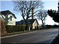
Iford, old waterworks
Old waterworks; later became printing works founded by Russian emigré Count Vladimir Tchertkov, as a blue plaque confirms. For details of Bournemouth's blue plaques, see: http://www.bournemouth.gov.uk/Library/PDF/Living/Planning/Environment/Conservation/BluePlaque/BluePlaque_1-19.pdf
Image: © Mike Faherty
Taken: 14 Jan 2009
0.04 miles