Tuckton: footpath I20 reaches Iford Close
Introduction
The photograph on this page of Tuckton: footpath I20 reaches Iford Close by Chris Downer as part of the Geograph project.
The Geograph project started in 2005 with the aim of publishing, organising and preserving representative images for every square kilometre of Great Britain, Ireland and the Isle of Man.

There are currently over 7.5m images from over 14,400 individuals and you can help contribute to the project by visiting https://www.geograph.org.uk
Tuckton: footpath I20 reaches Iford Close
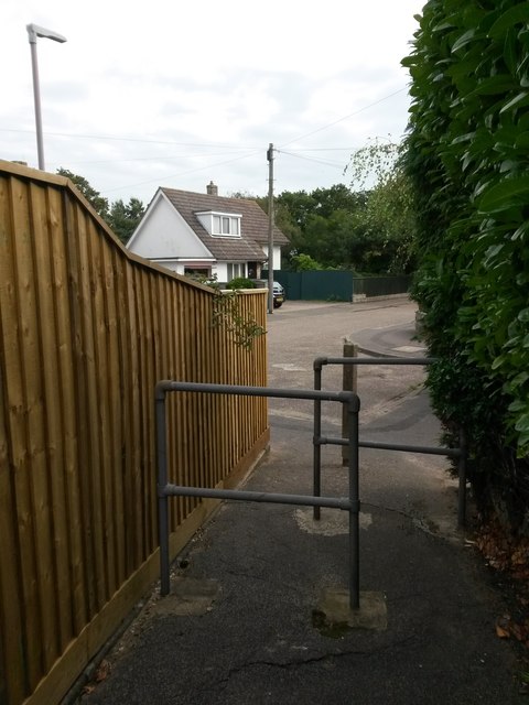
Image: © Chris Downer Taken: 24 Sep 2016
A public right of way from Saxonbury Road, footpath I20, follows a rear access driveway and then this alley, arriving here at the dead end of Iford Close. Unusually the extent of the public right of way, as mapped, appears to comprise only the driveway and exclude the alley itself. See Image for the view towards us from the middle of the road ahead, and Image for the next view on the path behind us, with links to further photos on the route.
Images are licensed for reuse under creativecommons.org/licenses/by-sa/2.0
Image Location


Leaflet Map data © OpenStreetMap
Latitude
50.732117
Longitude
-1.795484