
IMAGES TAKEN NEAR TO
Wick Lane, BOURNEMOUTH, BH6 4LD
Introduction
This page details the photographs taken nearby to Wick Lane, BH6 4LD by members of the Geograph project.
The Geograph project started in 2005 with the aim of publishing, organising and preserving representative images for every square kilometre of Great Britain, Ireland and the Isle of Man.

There are currently over 7.5m images from over14,400 individuals and you can help contribute to the project by visiting https://www.geograph.org.uk
Image Map
Images are licensed for reuse under creativecommons.org/licenses/by-sa/2.0
Notes
- Clicking on the map will re-center to the selected point.
- The higher the marker number, the further away the image location is from the centre of the postcode.
Image Listing (53 Images Found)
Images are licensed for reuse under creativecommons.org/licenses/by-sa/2.0
Image
Details
Distance
1
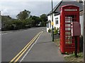
Wick: postbox № BH6 193, Wick Lane
In the centre of Wick village, this Elizabeth II-reign postbox has not seen a paintbrush as recently as the phone box has.
Image: © Chris Downer
Taken: 5 Jul 2008
0.05 miles
2
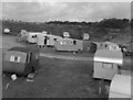
Hengist Caravan Site, near Christchurch, Hampshire
Following World War Two, when it again became possible to take a holiday on the South Coast, an inexpensive way to do so was to hire a caravan on one of the numerous sites which were springing up in many places. This one was Hengist Site, operated by a character of dubious provenance known as 'Captain' Smith.
The vans were far from comfortable, but it was convenient for walks along Hengistbury Head and into Christchurch.
Image: © Dr Neil Clifton
Taken: 21 Aug 1950
0.07 miles
3
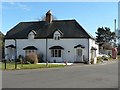
Wick: Quality and Tranquility
The idyllic names of these two cottages on the green at Wick – a quintessentially English scene, if only 'Tranquility' were not spelt the American way.
Image: © Chris Downer
Taken: 9 Mar 2008
0.07 miles
4
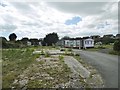
Wick, Hengist Park
Caravan park, partially demolished. Remaining occupants have contested eviction notices. https://www.bournemouthecho.co.uk/news/15389538.residents-living-at-hengist-park-are-ordered-to-leave-within-weeks-because-of-future-development/
Image: © Mike Faherty
Taken: 5 Jul 2020
0.08 miles
5
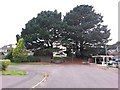
Wick: the dead end of Ariel Drive
The road comes to an abrupt end but a public footpath continues up the little bank to Verwood Crescent.
See Image for a view from the bottom of the footpath, and links to further pictures on the path.
Image: © Chris Downer
Taken: 24 Sep 2016
0.08 miles
6
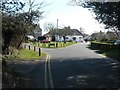
Wick: the green
A rare villagey feel to a Bournemouth suburb, Wick remains unspoilt despite the never-ending sprawl of the town.
Image: © Chris Downer
Taken: 9 Mar 2008
0.08 miles
7
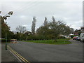
Wick Green
The old village of Wick, now a slightly remote suburb of Bournemouth, still retains several attractive rural touches, such as the green here. Other parts of the village have been marred by inappropriate planning permission.
Image: © Mike Faherty
Taken: 3 Nov 2008
0.08 miles
8
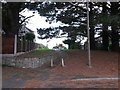
Wick: footpath I29 leaves Ariel Drive
Looking up this short public footpath from the dead end of Ariel Drive - the path follows an extension of the course of Ariel Drive, up the little bank to Verwood Crescent.
See Image for the view towards us from midway up the hill, and Image for a wider view from behind us.
Image: © Chris Downer
Taken: 24 Sep 2016
0.08 miles
9
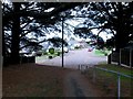
Wick: footpath I29 descends to Ariel Drive
This short public footpath leads down from Verwood Crescent to the dead end of Ariel Drive, which we see just ahead.
See Image for the view from behind us in Verwood Crescent, and Image for the uphill view from the road ahead.
Image: © Chris Downer
Taken: 24 Sep 2016
0.08 miles
10
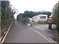
Wick: northern end of bridleway I27
This public bridleway is marked on Ordnance Survey maps as a byway open to all traffic (or B.O.A.T.) so I presume the designation has changed at some point over the last 20 years. It heads from Thornbury Road to the dead end of Wick Lane, and is realistically the original continuation of Wick Lane when it was a rural track.
Here, we see it from the dead end of Wick Lane. The driveway to a static mobile homes park is on the right.
See Image for the view towards us from ahead, with links to further photos on the route.
Image: © Chris Downer
Taken: 6 Mar 2017
0.09 miles