
IMAGES TAKEN NEAR TO
Southbourne Coast Road, BOURNEMOUTH, BH6 4BQ
Introduction
This page details the photographs taken nearby to Southbourne Coast Road, BH6 4BQ by members of the Geograph project.
The Geograph project started in 2005 with the aim of publishing, organising and preserving representative images for every square kilometre of Great Britain, Ireland and the Isle of Man.

There are currently over 7.5m images from over14,400 individuals and you can help contribute to the project by visiting https://www.geograph.org.uk
Image Map
Images are licensed for reuse under creativecommons.org/licenses/by-sa/2.0
Notes
- Clicking on the map will re-center to the selected point.
- The higher the marker number, the further away the image location is from the centre of the postcode.
Image Listing (144 Images Found)
Images are licensed for reuse under creativecommons.org/licenses/by-sa/2.0
Image
Details
Distance
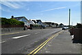
2
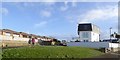
House with unusual roof and top floor
A distinctive building on Southbourne Coast Road; the picture in Google Streetview is dated 2012 and the building lacks the rail and screen outside the first floow window
Image: © David Smith
Taken: 25 Jan 2018
0.03 miles
3
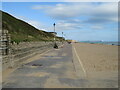
Promenade at Southbourne, near Bournemouth
A promenade runs for around 10 miles along the seafront through Bournemouth. This image was taken at Southbourne, near the eastern end of the promenade.
The promenade is on the route of National Cycle Network route 2. However, during the peak summer holiday months of July and August, the promenade is closed to cyclists between 10:00 and 18:00. Between these times, cyclists must use an alternative route.
In the distance, Hengistbury Head is straight ahead while to the right, the chalk cliffs are at The Needles at the westernmost tip of the Isle of Wight.
Image: © Malc McDonald
Taken: 17 Aug 2021
0.03 miles
4
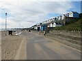
Promenade and beach huts, Southbourne
A promenade runs for about 10 miles along the seafront through Bournemouth. This image was taken at Southbourne, near the eastern end of the promenade. Here, the promenade is overlooked by beach huts.
The promenade is on the route of National Cycle Network route 2. However, during the peak summer holiday months of July and August, the promenade is closed to cyclists between 10:00 and 18:00. Between these times, cyclists must use an alternative route.
Image: © Malc McDonald
Taken: 17 Aug 2021
0.03 miles
5
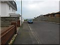
Southbourne: Ferry Road approaches the coast road
This road appears to be like any other hereabouts, but it is designated as a public right of way - Byway Open to All Traffic (or B.O.A.T.) number I08. Large-scale mapping appears to specifically mark the route as this southern pavement, although because of the angle of the junction ahead, it is the northern pavement that extends the farther.
In the background, we see the end of the road, blocked off for vehicles, coming out onto Southbourne Coast Road at the junction of Warren Edge Road.
See Image for the view up from the end of the road ahead, and Image for the next view on the road behind.
Image: © Chris Downer
Taken: 11 Feb 2017
0.03 miles
6
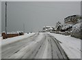
Southbourne Cliff Road, snowscene
An unusual scene in Bournemouth, after a night and morning of snowfall, with forecasts indicating that freezing temperatures will persist.
Image: © Mike Faherty
Taken: 2 Dec 2010
0.03 miles

8
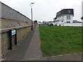
Southbourne: Ferry Road from its western end
This road appears to be like any other hereabouts, but it is designated as a public right of way - Byway Open to All Traffic (or B.O.A.T.) number I08. Large-scale mapping appears to specifically mark the route as the southern pavement, although because of the angle of the junction ahead, it is this northern pavement that extends the farther.
We are at the roadside of Warren Edge Road, just where it comes out on Southbourne Coast Road on our right.
See Image for the next view on the road ahead, with links to further photos along the route.
Image: © Chris Downer
Taken: 11 Feb 2017
0.04 miles
9
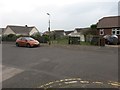
Southbourne: Admiralty Road used to continue ahead
Admiralty Road is a public right of way, number I07, designated as a Byway Open to All Traffic (or B.O.A.T.). This previously applied to the whole length of the road, but the road has been truncated now, just here, and the designation of the right of way truncated to a point some way behind us, according to recent mapping.
Looking across Ferry Road, we can see a 'road-shaped' wedge of land, heading acutely to the left, with the obvious fence along the right-hand edge and a wire fence doing similar on the left-hand side, just to the right of the lamppost. It is not clear exactly to which properties the land now belongs, if any.
See Image for the next view on the road behind, with links to further photos heading back to the part still designated a byway.
See Image for a view from the next available part of the defunct course of the road ahead, with links to further photos in that direction.
Meanwhile, Ferry Road is also a B.O.A.T. - see Image for the next view along that route.
Image: © Chris Downer
Taken: 11 Feb 2017
0.04 miles
10
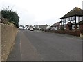
Southbourne: westbound along Ferry Road
This road appears to be like any other hereabouts, but it is designated as a public right of way - Byway Open to All Traffic (or B.O.A.T.) number I08. Large-scale mapping appears to specifically mark the route as the southern pavement.
Just ahead of us, Admiralty Road turns off to the left and used to also head right as another B.O.A.T. - see Image for relevant discussion and further links.
See Image for the next photo on Ferry Road behind us, and Image for the next view ahead.
Image: © Chris Downer
Taken: 11 Feb 2017
0.04 miles