
IMAGES TAKEN NEAR TO
Avon Road West, CHRISTCHURCH, BH23 2DF
Introduction
This page details the photographs taken nearby to Avon Road West, BH23 2DF by members of the Geograph project.
The Geograph project started in 2005 with the aim of publishing, organising and preserving representative images for every square kilometre of Great Britain, Ireland and the Isle of Man.

There are currently over 7.5m images from over14,400 individuals and you can help contribute to the project by visiting https://www.geograph.org.uk
Image Map
Images are licensed for reuse under creativecommons.org/licenses/by-sa/2.0
Notes
- Clicking on the map will re-center to the selected point.
- The higher the marker number, the further away the image location is from the centre of the postcode.
Image Listing (36 Images Found)
Images are licensed for reuse under creativecommons.org/licenses/by-sa/2.0
Image
Details
Distance
1
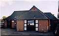
Christchurch Family Church
The building is known as Hope House.
Image: © Michael FORD
Taken: Unknown
0.07 miles
2
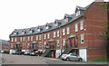
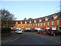
Regency Crescent, Fairmile
This imposing development consists of several crescent-shaped apartment blocks, seemingly inspired by the Royal Crescent at Bath. This block is interesting in having the entrance doors at first-floor level, with garages at ground level. The development is on land formerly occupied by the Victorian hospital nurses' home, which was demolished, against the wishes of local historians and conservationists.
Image: © mike smith
Taken: 15 Aug 2007
0.08 miles
4
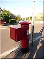
Jumpers: postbox № BH23 41, Grove Road West
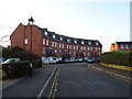
Above this George V-reign postbox, we look along Avon Road west from the junction with Grove Road West. There are the reciprocal 'Easts' for both roads, which meet similarly. The box is emptied finally at 5:30 on weekday evenings and at 12:15 on Saturday afternoons.
Image: © Chris Downer
Taken: 23 Jun 2009
0.10 miles
6
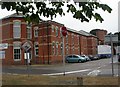
Christchurch Hospital
Originally Union Workhouse, now hospital specialising in rehabilitation. http://www.rbch.nhs.uk/template2.php?link=about_us_new&page=hospitals#Christchurch
Image: © Mike Faherty
Taken: 6 Aug 2010
0.12 miles
7
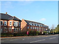
Clarence Place
This is a large development of houses and apartments just off Fairmile Rd built in an unusual curving formation. Taken from the other side of Fairmile Rd close to the junction with Knap Hill Avenue.
Image: © Nigel Mykura
Taken: 15 Nov 2011
0.14 miles
8
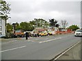
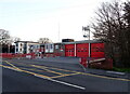
Christchurch Fire Station
On Fairmile Road. Today was the station's open day, with an impressive exhibition of hardware and demonstrations: http://www.dorsetfire.gov.uk/events/christchurch-open-day/
Image: © Mike Faherty
Taken: 26 Apr 2015
0.16 miles
10
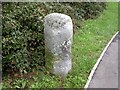
Old Boundary Marker by the B3073, Fairmile Road, Christchurch
Parish Boundary Marker by the B3073, in parish of Christchurch (Christchurch District), Fairmile Road, 32m South of roundabout.
N.B. Listed as a milestone, but the 1888 O.S. map shows it as a 'BS' on the Municipal Boundary.
Grade II listed.
List Entry Number: 1110100 https://historicengland.org.uk/listing/the-list/list-entry/1110100
Surveyed
Milestone Society National ID: HA_CHRpb
Image: © Milestone Society
Taken: Unknown
0.16 miles