IMAGES TAKEN NEAR TO
Ullswater Road, WIMBORNE, BH21 1QT
Introduction
This page details the photographs taken nearby to Ullswater Road, BH21 1QT by members of the Geograph project.
The Geograph project started in 2005 with the aim of publishing, organising and preserving representative images for every square kilometre of Great Britain, Ireland and the Isle of Man.

There are currently over 7.5m images from over14,400 individuals and you can help contribute to the project by visiting https://www.geograph.org.uk
Image Map
Images are licensed for reuse under creativecommons.org/licenses/by-sa/2.0
Notes
- Clicking on the map will re-center to the selected point.
- The higher the marker number, the further away the image location is from the centre of the postcode.
Image Listing (23 Images Found)
Images are licensed for reuse under creativecommons.org/licenses/by-sa/2.0
Image
Details
Distance
1

Station Road, Wimborne Minster, Dorset
A rare sight on the roads today, a Citroen 2CV "Beachcomber".
Image: © Jules
Taken: 14 Jan 2014
0.06 miles
2
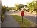
Merley: postbox № BH21 130, Oakley Hill
Looking down Oakley Hill towards the bridge over the Stour, past this postbox which receives its final collection at 5:30pm on weekdays and now at 11:30am on Saturdays – the latter time displayed on a sticker over whatever the Saturday collection used to be.
Image: © Chris Downer
Taken: 10 Jun 2009
0.15 miles
3
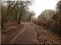
Willett Road
This is the old road from Oakley to Lamb's Green, now duplicated by the modern A31 off to the left. It can be followed as a bridleway beneath the A road, and is numbered BR114, although it isn't at this stage shown as a right of way on the maps.
Image: © Derek Harper
Taken: 27 Jan 2010
0.15 miles
4
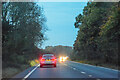
Oakley : Wimborne Bypass A31
Heading along the A31.
Image: © Lewis Clarke
Taken: 18 Oct 2020
0.17 miles
5
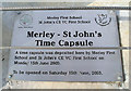
Canford Bridge Time Capsule
School's on each side of the new footbridge were asked to contribute to this time capsule. I don't think I'll be around to see it opened though.....
Image: © Peter Kazmierczak
Taken: 26 Oct 2009
0.19 miles

7
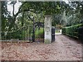
Oakley, turnstile
Turnstile at the beginning of the footpath from Oakley Hill to Stapehill, next to Wimborne Lodge, and the former drive to Canford Hall. There is another turnstile to the right; both were presumably originally to keep livestock out, but now exclude cyclists.
Image: © Mike Faherty
Taken: 25 Oct 2009
0.20 miles
8
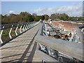
Oakley, footbridge
A new footbridge attached to Canford Bridge, on the main road from Poole to Wimborne. Graceful, certainly, but perhaps not in keeping with the early C19 stone and brick bridge. http://www.dorsetforyou.com/index.jsp?articleid=390845
Image: © Mike Faherty
Taken: 25 Oct 2009
0.20 miles
9
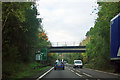
A31 - B3073 bridge
Beyond is a roundabout where the A349 turns left for Poole.
Image: © Robin Webster
Taken: 30 Oct 2012
0.21 miles