
IMAGES TAKEN NEAR TO
East Borough, WIMBORNE, BH21 1PE
Introduction
This page details the photographs taken nearby to East Borough, BH21 1PE by members of the Geograph project.
The Geograph project started in 2005 with the aim of publishing, organising and preserving representative images for every square kilometre of Great Britain, Ireland and the Isle of Man.

There are currently over 7.5m images from over14,400 individuals and you can help contribute to the project by visiting https://www.geograph.org.uk
Image Map
Images are licensed for reuse under creativecommons.org/licenses/by-sa/2.0
Notes
- Clicking on the map will re-center to the selected point.
- The higher the marker number, the further away the image location is from the centre of the postcode.
Image Listing (70 Images Found)
Images are licensed for reuse under creativecommons.org/licenses/by-sa/2.0
Image
Details
Distance
1
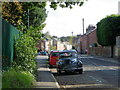
Morris Minor, Wimborne Minster
The car is parked on East Borough.
Image: © Maigheach-gheal
Taken: 25 Sep 2011
0.01 miles
2

East Borough, Wimborne, west side - Hartlands (detail)
The doorway of Hartlands consists of a 6 panel door in a classical surround, with a broken pediment hood and entablature, with an ornamental frieze and Ionic pilasters.
Image: © Mike Searle
Taken: 22 Mar 2015
0.03 miles
3
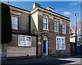
East Borough, Wimborne, west side - Hartlands
East Borough also starts from the town centre heading north and parallel with West Borough. Almost at its most northerly point is Hartlands, at no. 77, late C18 to early C19, and grade II listed. Of interest are the hood moulds above the first-floor windows that are carried on carved or cast heads, likewise on either side of the window of the later single storey extension to the left. http://www.imagesofengland.org.uk/Details/Default.aspx?id=107057&mode=adv
Image
Image: © Mike Searle
Taken: 22 Mar 2015
0.03 miles
4
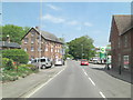
B3078 approaches Walford Bridge
There's an industrial building adjoining Walford Mill House which is Grade II listed. It's on the left of the picture and originated in the 19th C. It has English Heritage Building ID: 107102.
Image: © Stuart Logan
Taken: 4 Jun 2013
0.07 miles
5
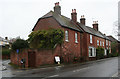
Old Toll House by West Borough, Wimborne Minster
Toll House by the B3078, in the parish of Wimborne Minster (East Dorset District), Nos. 46-49, (GR II listed as No.63) West Borough. The centre section with the bay windows is believed to have been the toll house.
Grade II listed.
List Entry Number: 1304037 https://historicengland.org.uk/listing/the-list/list-entry/1304037
Surveyed
Milestone Society National ID: DO.WIM02
Image: © Alan Rosevear
Taken: 10 Nov 2008
0.07 miles
6
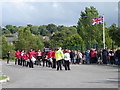
Dorset Youth Marching Band
The band are waiting to lead the local Beavers, Cubs, Scouts and Venture Scouts form Allanbourn Middle School to the Minster Church for a service to celebrate 25 years of Beaver Scouting.
Image: © Maigheach-gheal
Taken: 25 Sep 2011
0.08 miles
7
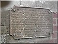
Old Bridge Marker by the B3078, Walford Bridge, Wimborne Minster Parish
Bridge Weight Plate by the B3078, in parish of Wimborne Minster (East Dorset District), Walford Bridge, South West corner of bridge parapet.
'Lost'
Inscription reads:-
COUNTY COUNCIL OF DORSET.
TAKE NOTICE THAT THIS BRIDGE
(WHICH IS A COUNTY BRIDGE) IS INSUFFICIENT
TO CARRY WEIGHTS BEYOND THE ORDINARY
TRAFFIC OF THE DISTRICT; AND THAT THE
OWNERS AND PERSONS IN CHARGE OF
LOCOMOTIVE TRACTION ENGINES AND OTHER
PONDEROUS CARRIAGES ARE WARNED AGAINST
USING THE BRIDGE FOR THE PASSAGE OF
ANY SUCH ENGINE OR CARRIAGE.
E. ARCHDALL FFOOKS
CLERK OF THE COUNTY COUNCIL OF DORSET
Walford Bridge is Grade II* Listed.
List Entry Number: 1119538 https://historicengland.org.uk/listing/the-list/list-entry/1119538
Surveyed
Milestone Society National ID: DO_WEIWIWbbr
Image: © M Faherty
Taken: 11 Apr 2007
0.08 miles
8
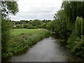
Wimborne, River Allen
As seen from Image; the river joins the Stour about 1500m to the South-east.
Image: © Mike Faherty
Taken: 31 Jul 2010
0.08 miles
9
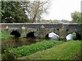
Bridge over the River Allen, Walford
There is a large patch of watercress by the riverbank.
Image: © Rose and Trev Clough
Taken: 16 Oct 2007
0.08 miles
10
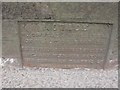
Old Bridge Marker by the B3078, Walford Bridge, Wimborne Minster
Bridge Weight Plate by the B3078, in parish of Wimborne Minster (East Dorset District), Walford Bridge, on East parapet, mid bridge, visible from road or by leaning over parapet from footpath. Partly buried in tarmac.
Inscription reads:-
NOTICE
TO OWNERS AND DRIVERS
OF TRACTION ENGINES
THIS BRIDGE IS INSUFFICIENT
TO CARRY WEIGHTS BEYOND
THE ORDINARY TRAFFIC OF
THE DISTRICT
Walford Bridge is Grade II* listed.
List Entry Number: 1119538 https://historicengland.org.uk/listing/the-list/list-entry/1119538
Surveyed
Milestone Society National ID: DO_WEIWIWabr
Image: © M Faherty
Taken: 11 Apr 2007
0.09 miles